Chinook
salmon, Coho, estuary fishing, bay fishing,
 |
Willapa Bay
Salmon Fishing |
 |
Unfortunately many times in today's
world, the PERCEPTION of fishing success is so low,
or because of restrictions,
that many have quit buying fishing licenses, and do
not go fishing even when a limited season is open. Or with "In-Season
Management", they cannot plan ahead because they do not know what area is open or closed.
This fishery is mainly a Chinook fishery, with the season officially, usually opens about the first of July, or
when the adjacent ocean waters are open, but the main salmon run does not really
enter the bay until the middle of August.
"Dip Ins" are salmon that are swimming down the coast, (probably heading for the
Columbia River) that follow the coastline, then when they come to a river/bay,
where fish food (usually anchovies) will drift into the bay with a incoming tide.
These salmon will be following THEIR food and also slide in an back out with the
outgoing tide. These are not salmon that are yet committed to the
spawning phase.
These few "dip in" Chinook can show from mid July until the first week
of August into the mouth of the bay, but unless you live there and/or have the
time, it is usually not practical to make a trip only to keep your fish-box clean.
There however can be a enough "dip ins" mixes with the regular Willapa run
to make it worthwhile from the first of
August on, as the usual timing with enough fish to begin to be productive would be about the middle of
August to the middle of September. This can very well change with the
weather however, as if it is hot, the warmer river water will keep these fish
out in the ocean longer.
Fish Run Timing Here
:
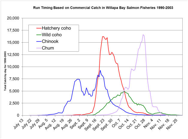
Shown below we see a chart prepared by WDFW showing Willapa
Bay salmon run timing. My take on the dual peak spikes for Chinook, is
since this chart shows commercial netting dates covering many years, where
the commercial season may have had a early minimal test Chinook fishery
would account for the minimal catch in July but did not get into full swing
until a month later, and that the slump between those spikes meant the
commercials took a sizable number of Dip In and/or stack up fish, then it
took a while for another wave to move in for the second spike.
However from this chart below, (1990-2003) which shows
pretty conclusively the time that you as a recreational fisher should
consider being on the water. However this timing may change slightly depending
on the weather.
Here the average hatchery Chinook here will be 10-18#, you will also encounter
up to 35 pound 4 or 5 year old big saltwater
Chinook, and when hooked in 14 to 25 feet of water, they can not go down, so do
put on a fight and occasionally may run. These fish return to the bay as
the result of three salmon hatcheries in Willapa Bay system, Forks Creek, Nemaha
and the Naselle. The
forecast for 2008 year’s Willapa Bay Chinook salmon return is around 35,000, a
healthy number compared to many other western Washington watersheds.
In 2010 the vast majority of Chinook were fin clipped, with
2011 being more clipped so
you can only retain the clipped hatchery fish. In the 10 days that I
fished here in 2011, we only encountered 1 unclipped Chinook out of 15 fish.
However most fishermen there in 2012 experienced a increase in unclipped fish.
The year 2014 for me was about 60% clipped as was 2015. This high rate,
for me is attributed to the many miles of the Willapa River above tidewater that
is spawnable water for Chinook and not controllable by WDFW's hatchery program.
The Willapa Bay/River above Tokeland can be fished with a
smaller boat, even a car-topper, IF YOU WATCH THE WEATHER, and stay within
reason, close enough to one of the launches. Almost always the westerly
wind picks up to near 15 MPH in the afternoon like most coastal locations which
can make for choppy water conditions and wet fishers in small open boats if you
have to buck these waves getting back to a launch, so here the
upriver launches are a benefit. Your normal fall bad weather will be
coming from the west or southwest (right up the slot where most of us fish). This allows for the wind/waves to stack
up from coming off the ocean, getting worse the farther they can go inside the
bay. If the wind is from the north or northwest, you have a lot more
protection from the surrounding higher hills.
And it can also be FOGGY here also,
usually in the mornings but can also be foggy in the afternoon, so take a GPS plotter with you, mark some locations off
a chart before you go. Also when you stop at the Tokeland Marina, consider
purchasing a set of two of their laminated charts for $8.50 each of the bay that
do list GPS locations.
Sorry this business has evaporated due to
the low salmon runs and WDFW mismanagement.
As mentioned, there is fog to contend with here at times. In the late
afternoon (after 4:30), I have seen it sock in so bad that without a GPS
plotter to guide me, it would have been very hard to find home (which ever
launch or dock you came from). However I have seen it foggy all
morning so bad you can maybe see 100 yards. It seems the farther
upstream in the bay you get the lesser fog is. Fog and wind HERE for a small boat is
not a good thing because of the narrow channel and adjacent mudflats,
especially on a outgoing tide.
I have seen 12' Port-a-Boats, 14' Jon
boats, even a 10' Zodiac, 2 people aboard, with only an electric trolling motor
for power there. Not ideal, but OK, IF they understand the possible
weather conditions and react as soon as the wind begins to blow.
|
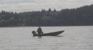
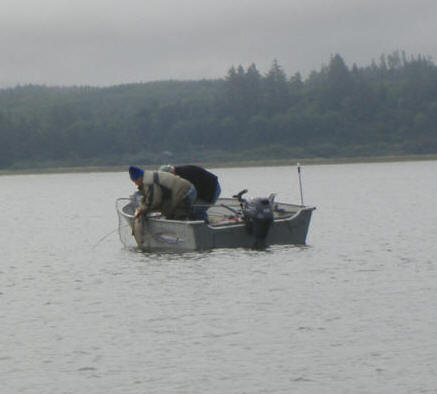
Here a
small Jon boat fisherman on a calm 2012 day
|
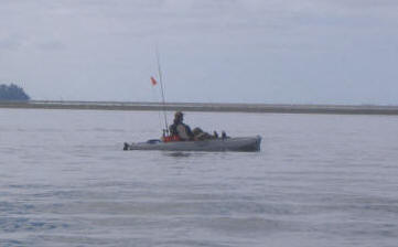
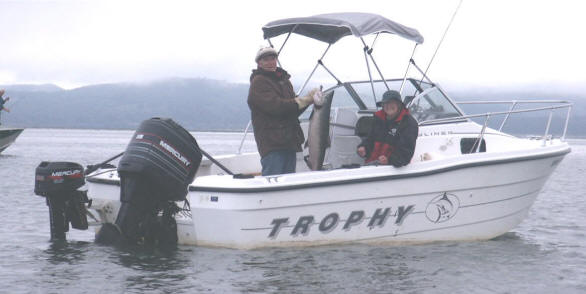
Here is a
Hobbie Craft fisherman, again on the same calm 2012 day |
 |
 |
|
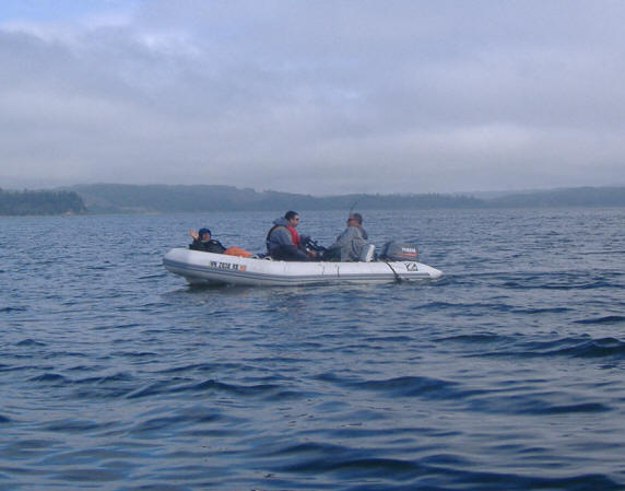
Ribbed inflatable Zodiac type boat in 2013 |
Here a nice Chinook in the net & coming aboard 2014 |
 |
 |
Every year there are some nice Chinook and some Coho taken from these waters. The salmon runs coming in from the ocean to
their spawning grounds in the river can be influenced by many things such as tides, ocean conditions,
river water flows, water temps, light levels and more. The biggest factors in
some opinions are the temperatures, tides, and water flows. However
do not discount an over abundance of baitfish (usually Anchovy) to where
they are so thick in places that your sonar indicates you are on a sand bar,
but you know you are in 30 or 40' of water. In cases like this, there are so many that your
single lure gets lost and the fish are not really hungry. For a
link to my Estuary Fishing
CLICK HERE.
As the salmon start entering the bays in enough quantity for the sport
fisherperson to have any success about the first week of August, they are still feeding and following the baitfish in and out with the tides.
In these areas the most popular and successful method of fishing for salmon is using herring, anchovies or other food fish that the salmon feed on in the ocean.
The Coho won't normally start showing in any numbers until about the middle/end of August, or even later. The Chum population has been all but decimated, but with WDFW plans of recovery
putting them inline to avoid a ESA listing. This is no directed chum
fishery (either sport or commercial) and restarting a hatchery program, with the long range goal to bring
them back to historic levels. Abundant Chum fry in the bay provide food
for other fish, like the Chinook or Coho fry.
| A 30 # class Chinook in the boat for Doug & Lois Stowe aboard the "Lucky
Lois", using Plaid Fish Flash & whole rigged herring in 2007. And he does
it again repeatedly even into 2013. Who says you can't have fun fishing
even if you are in your mid 80s, even with Lois getting around by the aid
of her walker because of MS. Sad to hear she passed away in May of
2014. |
An
18# Chinook taken by the author on a 6" Fish Flash & herring in a Les Davis
bonnet
9-12-05 |
 |
 |
Fish Travel Times :
It has been my observation that in the early part
of the salmon season, (early July to early August) in the outer area of the bays during (first 2-4 miles) that fresh
ocean salmon will "dip in" at a high incoming tide following the bait. These
fish will usually also move out with the outgoing tide. The lower area of
fishing at this time is what has become known as "Washaway Beach", which is
on the north side of the river mouth up to the rock breakwater. This "dip
in" fishery could extend up river upper and end at about river marker #2 (just
outside of the Tokeland boat basin) depending on the bait and the tide.
You notice I said FRESH OCEAN fish, these fish are not anywhere near
approaching the upstream migrating, spawning fish that you will encounter later
in mid August or September. About 50% of these early fish are
mostly headed south to the Columbia River (as verified by WDFW commercial
netting at that time). I have even caught a 20#
Columbia River Chinook Tule here in mid August. The later fish are
committed to entering their home streams for a rendezvous farther upstream on
the gravel and they travel differently.
For many years fishermen have believed that salmon are flushed into
the river mouth on the incoming tide. Yet salmon have to face into the
current in order to breathe, so if this is the case the fish will be headed
downriver/into the incoming tide, but moving upriver with the tide. This will not allow
them to see where they are going. OK, but what if they are chasing baitfish? By doing this, they will be moving under their own power and going in a
direction of food which is in turn being flushed upstream.
Now once
these salmon are in the upper part of the estuary, (above Tokeland) when the tide starts to
go out, what do they do? Depending on their sexual maturity, some may stay
in the estuary for a while. Some may return to the ocean on the
outgoing tide, again chasing
bait. This scenario could happen numerous times, some returning while others
may remain to later move upriver to spawn.
But what about the more
sexually mature fish that are not that really interested in food? They use
the smell of their home stream to navigate, so logically the upriver
migration may take place in the outgoing tide, where the salmon can swim
into the current, smell home, and use it to navigate that direction.
On LARGE rivers like the Columbia during the fall migration, there may be a
mix of both incoming/outgoing tide fish. Could it be possible that this
"flush in" just happens to be when the most fish were congregated there and
initially caught by charter boats which developed the easiest time for
catching (Buoy 10 firing line)?
Now how does this relate to smaller
estuaries like Willapa Bay or Grays Harbor where there is no a large number
swimming over the bar at any given tide? To have fishable numbers for the
recreational fleet here, the fish have to "stack up" in holding areas. Now add to
that, these recreational fishers have to have the fish as a "WILLING BITER". So which is
the best time for a fisherperson to fish in any given area of the estuary??
Once they are committed to the flowing river it probably makes
little difference except if the high incoming tide seems to be what allows
more water flow, allowing them into the actual upper section of the bay,
then to move into the upper tidewater section, waiting for rains that will
send them into the main
flowing river. But water temperature will also play into this.
Fish the Bottom ? : Most
fishermen have been told repeatedly to fish close to the bottom for Chinook.
However it has been my observance that returning salmon seem to use the sides of the
river channel in the estuary as a guidance system. They normally do not
follow the bottom of the center of the channel (how do they know?), but by following the sides of
this channel while in the bay, where they have some additional guidance.
Now consider this
-- At a slack tide, (either high or low, but normally high because at a low
tide there is usually not a lot of water other than the shrunken area.
Where do these slack tide salmon get there guidance? There is no current, so
they probably seem to become bewildered and mill around waiting for a tidal
movement. Many are caught at mid-water depth at
these times. So, it may be best to at a slack tide, instead of dragging a
bait near the bottom as you were doing hours before, is to raise it up to
mid to upper water depth, (even 15' out with a 4 oz. or less sinker).
Also entering into this mix will be water
temperature in the area you are fishing (which will change with the tide).
Late summer if the weather has been hot, I have seen water surface
temperatures in the rivers at 66 degrees PLUS, while if you travel
downstream to the mouth, ocean water temperature can be 52/53 degrees. This
can also be a contributing factor of where to find your fish, as Chinook
ideal water temperature is between 48 and 55 degrees. However remember that
the ocean salt water is heavier than fresh water, so in the mid to lower
areas (like the bay marker #15 west of Tokeland), the salt water will
dominate the bottom. Farther upriver near river marker #10 would
be a whole different story.
You may find a smaller
river entering the main river that has a cooler watershed (North River). If this is the
case, even 2 degrees may be a place to look for your fish at the mouth of
this cooler smaller river.
Now here is something that may drastically
alter the water temperature downward. It has been observed that during a hot
weather season, if you have a number of deep minus tides (-1.5 plus) that
there seems to be a large enough flush of backed up warm river water out to
sea, which is then replaced by cooler ocean water. On 8-9-14 at a high
tide after a -1.5 low tide, the water temperature at river marker #8 was 57.7
degrees (8-10-14 it was 55.7). This is cooler than just a few days for
a normal low tide that was observed at 64. During these minus tides, many
fish that entered the bay on the incoming tide and were caught from Washaway
Beach up to river marker #10. Even Coho were caught in numbers at Washaway.
I suspect fish were even farther up, but the fishermen were content to stay
lower down and catch fish than to chase possible fish farther upriver.
Another thing, on these deep minus tides (at river marker #2, on the outgoing from
mid tide on to about mid incoming the water temp is going to be high, (like
65) AND greatly discolored, which will also effect fish catching. It also
seems to scour the bottom of the partly decayed weeds, bringing them back up
to possibly being suspended.
So taking all this into account, it may
behoove you to alter you fishing depth, depending on the area, tide and
water temperature. Like during a slack or incoming/outgoing tide fish
mid depth with a 4 oz sinker (10-15' down or possibly 25' of line out for a
normal with the tide trolling speed). For a mid tide where the full force of
the water is moving, then consider fishing nearer the bottom (heavier sinker, 8 or
10 oz, or even more).
Some of the fishermen who stay there during the season in
RVs, moor their boats do not even leave the dock unless it is near an hour
prior to high
slack. However, I rather like the low tide fishing, as in my book this concentrates
the fish more especially if the water temperature cools down. If you get there before the low slack, then remember
the downstream troll as it puts your lure in their face. Some of my
best bites some years have been about 2 hours after low tide, between
river markers #2 and #13.
This Willapa Bay/River system is in reality a small system in relationship to
others, so depending on a lot of variables, there are not a lot of Chinook that
swim across the bar at any given tide change. They will move into the system either
alone or in small schools and congregate in the mid bay. So depending on the
weather (rain, or lack of it) they may stay there, or move upstream rather
quickly if it rains even a slight amount. This may leave a void in the
fish concentration area for a
while. It then may behoove you to run downriver to Washaway to try to
intercept new arrivals, then slide upstream with them until the process starts over.
You will almost always do a downstream troll, HOWEVER if
the tide/current is moving fast enough that your gear will not stay down,
then it may be best to consider shutting the kicker motor off and just drift with the tide.
And how many of you have been told to fish the bottom for Chinook. Well that may not be totally valid
depending on the tide as mentioned above.
Now here, when encountering lots of floating weeds, one of
the better guides has suggested that instead of trying to jockey your line
around these gobs, was to poke your rod tip section down DEEP into the
water, (as straight down as possible) as you trolled through them and let
these weeds accumulate on the rod. Then when you are through them, raise
your rod and shake the weeds off. This works surprisingly well in that
the rod runs interference and keeps the weeds off the line. This saves
a lot of time and lost time of your lure in the water fishing.
Now twice I have had a salmon hit while I had the rod
poked into the water. First time, I just passed it off as unimportant.
But the second time it happened, BINGO, a light came on in my pea brain.
Was I possibly not fishing deep enough at that time, (possibly a depression in the
bottom?) or what other reason. I then realized that by dropping my rod
tip deep into the water, with a 8'6" or 9' rod, I have effectively done the
same as letting out possibly 25' of line, lowering my lure maybe 6' to 10'
depending on my rod-holder preset angle. This has proved effective if
trolling with your rod in a rod-holder and a uneven bottom as seen on your
sonar.
So if you are not getting a
bite, you might just try this trick, instead of letting more line out.
Kind of like kicking your trolling motor into neutral, or making a turn and your rod would be on the inside, going
deeper.
Water Temperature Plays a Role Here :
As mentioned above, water temperature will vary with the tide
and how far upriver you venture.
Temperatures for the year 2006 taken off the Willapa River marker #13 east of Tokeland varied from 56 degrees at
a high tide to
61 degrees at a low tide, but this was on a high runoff tide in early September. Then
later with a low runoff, it was 64 /67. 2006 saw a temperature of 61
degrees at high and 63.5 at low tide. 2007 saw a temperature of 59 /
66 degrees. 2009 I saw 56 / 66 degrees to 55 / 62.5 depending on the
month. 2010 was 61 / 64.5. 2011 was 61.5 / 66.7 in late
August but by mid September it was down to 59.7 / 63.6. 2012 saw
temperatures of as low as 59.7 low down at a high tide and up to 66.6
upriver near marker #15 as the tide was running out. The year 2015 being a
very warm year, mid August upriver water temperature was 69.1 and 69.2 at a
high tide, but 66 at marker #2 and 62 at washaway.
This variation happens depending on the amount of cooler ocean water is mixed with the
warmer lower river/upper bay water. It also varies with the amount of
run-off there is in the tides as in a large outflow, normally cooler ocean
water replaces some of the warmer bay water. It seems that the warmer the water, the less the fish
bite. North River water is normally a degree or two lower than
the Willapa, so that may be why the fish seem to concentrate around markers #10 to #13
if the temperature is up.
Now you have to remember that these water temperatures are of surface
water, on an incoming tide the salt water being heavier will be near the
bottom, which in the early fall where the surface water is warm, the fish
may seek refuge nearer the bottom.
If the water is warm and you can not get any bites,
switch your normal bait lure over to spinners, as sometimes this will make a
difference.
|
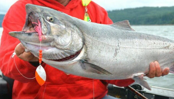
For some reason Chinook seem to hit spinners better
in warm water. |
 |
After extensive trial and error here, it has become very apparent that early in
the fishing season (early August) if there is little or no rain, the Willapa
River water can become rather warm. Upriver water temperature above
Raymond has been recorded in the 67/68 degree range. Depending on the amount of sunlight and
wind on any given day, or cloud /fog cover for the preceding days, the
water's surface temperature at low tide at marker #13, (the mouth of North
River) can be from 63, to even near 68 degrees depending on the time of the
tide. This is rather warm for
salmon, which usually ignore it if possible, but if forced into it, they may get lethargic, which may explain why, even though the fish
may be there, they may not a willing biter.
But something else has entered the picture cooling the warm water that
is a benefit to the recreational fisher. Numerous deep MINUS tides are
good in the fact that they allow a lot of the warm backed up river/bay
water to escape and be replaced with cooler ocean water. This seems to
attract the fish and I have seem the temperature change from a low tide
temperature at marker #8 of 64 degrees to at a full high tide of 56 degrees.
When this happens, the fish will follow that temperature, so be ready and on
the water then. However also be prepared for a lot more weeds because
of the high runoff.
With the incoming tide
where cooler ocean water mixes with and backs up the warmer fresh water,
this area between west of marker #2 (Tokeland) and upriver to about #19 can
cool down slightly. This in my mind may be one of the major
contributors of what triggers the high tide bite from an hour prior and
possibly two hours after the published low tide.
The Chinook may be there in the upper bay (above
marker #13 to
#19) in
this warm low tide water, (and I have seen them jump and have caught a few)
however it is my experience they are not aggressive biters UNLESS you may happen to drag
your bait right in front of their noses. Then if no baitfish are there
for some time, maybe they become hungry and their feeding habit changes.
Now comes deciding
just when to be on the water which affords you the fisherman the best
CATCHING time? Here your tide-book is your friend. The tides for Pacific
Beaches is the one to look at, but add about 45 minutes to that for the
tides off Toke Point (marker #2) and probably another 15 minutes up to #19.
The
IDEAL fishing time would be a
morning high tide of say 7-8AM. This would allow you to be there at
daylight, fish the prime flood tide and do some crabbing or sightseeing in
the afternoon. A high tide up to noonish is also fine, you just don't have
to get up as early. A afternoon high tide is also OK IF it does not go later
than 3 PM. The reason is that USUALLY a wind from the SW will pick up from 1
to 2 PM, which within a couple of hours, it is not uncommon to have wind
waves to 2' and 12' apart. Sometimes it may flatten out a tad bit
later nearer evening, but don't
count on it. For a small flatter bottomed open boat this creates for a rough
ride and wet fisherman on the return trip downriver to the Tokeland docks.
Unless you launch at South Bend or Smith Creek, which then you do not have
to contend with heading into these waves, but can return to your launch
going with the wind.
On this high tide bite, the best fishing tends to be on the
south side of the river channel from river marker #2 to #8 and then on to #10. At
#13 you are then on the north side of the channel. It gets shallow
(15') near #17 but drops off to 25' near #19.
Start one hour before high tide at west of
river marker #2 about 1/3 a
mile, head to NEAR #2, (either side), but remember there is a sand bar and
oyster beds not far south of it, then head toward #8 trying to stay in water from
24' to 32'. As you get closer to #8, it shallows up, (14'- 16') so cut
that corner and
angle off toward #10 trying to stay near the 25-30' depth.
In addition to this, Chinook salmon seem
to congregate west of there (#13) as there is a deeper channel from the
north side of #10 and west past #7 and then toward north of #2 a ways at a
depth of about 40+'. This deeper water seems to be a haven for the
fish as given the depth AND that North River's slightly cooler water
temperature, mixing with the Willapa River water, this tends to create a
pocket of cooler water downstream for a couple of miles in this deeper old
shipping channel. So on a outgoing tide, with this in mind, if you
have to fish the outgoing tide, this slot may be one to think about that not
many fishermen seem interested in.
All the above said, I have caught salmon here
on the low tide, (usually one hour after low tide) but this was later in the
season, like the first week to the middle of September where the fish seem
more committed to being closer to the spawning grounds AND more abundant
along with being confined in the river channel, otherwise it seems to be more
of an isolated fish and not be a "bite" where other boats around you are
also catching fish.
If I were to rate catching times/tides, with 100
being the best, 100 would be for high tide a early morning (daylight, 85
would be mid morning, 75 a afternoon. For the low tide I would
probably assign a 65 early morning, 55 for mid morning, with 45 a afternoon
number. BUT if you relied only on these time-frames and tides, at
times you may not be fishing, REMEMBER if your lure is not in the water you
certainly will not get your fish box smelly.
One other thing that can be thrown
into the mix is if there is a lot of baitfish in the bay. If you get
where there is a LOT of them (usually anchovy), your odds go down because
the salmon are not really hungry, as they will be stuffed. I have seen the water so full of anchovies that the sonar does not work, thinking
you are on a sandbar. Your only hope then is to move, or fish deeper (below the bait).
These fish move into the bay then basically mill around there (between
river marker #2 and upriver to # 15) until the weather changes and we get some rain (lowering the
water temperature). SOON (VERY SOON) after a rain, ANY AMOUNT OF
RAIN, they start migrating upstream
and if you want to catch them you need to also move and fast. The first day after a
rain, they tend to be up to the town of South Bend or
even above. After that they move a lot farther upstream, and seem to
congregate at the upper end of tidewater near the Old Willapa (Wilson Creek) boat
launch and the bridge near the Tombstone Willie tavern. However up here
the lure is usually a spinner. And the river itself gets smaller and with
a number of underwater debris to where smaller boats, here 12' - 16' have their
benefits.
The Weather/Wind Plays a LARGE Role Here :
This time of the year (mid fall) fog can be there all morning, or
it may set in later. A times like this, a compass and even a handheld GPS with your launch point
along with a few buoy locations will give
you some references that in addition to your depthfinder will allow you to at
least feel not as lost as you could be. At a low tide, the mud flats on either side
of the channel kind of reaches up and grabs some boat hulls which has taken their toll
on de-painting props if the skippers are not watching very closely AND
understanding what they see even in broad
daylight.
As the time moves into September and since this bay is exposed to the ocean
you may get a sample of fall storms of any southerly or westerly winds up into
the 25 to 30 MPH strength, the outer bay will in all probability be unfishable.
The waters even off the Tokeland Marina entrance up to Willapa River markers #8
and and 10 will also probability be somewhat unfishable. However you MIGHT
find the water calm enough to possibly fish farther upriver close to marker #19
up to the westerly range marker, nearing the bend
and up to the South Bend launch.
If the wind picks up in the fall of the year here, it can also usually be
accompanied by rain. That is good in that it also brings in new fresh ocean fish
into the bay/rivers. So, all the more need to consider sliding upriver as
these fish are freshwater bound by then and usually do not linger very long in the
estuary then.
One observance that I have made is that on these
South and South-Westerly winds where the wind blows directly up the bay or in
from the ocean and into this Southerly exposed bay, is that at a 1/2
tide or more with a couple of feet of water over the oyster beds and
these winds blow across the water, that the Northern side of the bay
will get so bad that I have had water come over the bow and over my
convertible top when trying to get to the fishing areas. Yet, by
waiting three hours as the tide goes out, the wind is still blowing, but the oyster beds are
now exposed and the wind has less of a chance to effect the now minimal
amount of water, it will then be fishable on a low tide.
This bay can be flat calm in the morning and then REAL
choppy for a small boat in the afternoon. And as the time/season
slide into fall, it can get unsafe for even some larger boats. The
first part of September 2015 was one of these situations. It was high
tide at daylight and the wind was coming in from the SW (gathering force as
it came across all of the now open water to the southwest) I have an
aluminum 18' North River 12 degree bottom convertible topped boat powered by a 75hp Evinrude
E-Tec motor. The waves were so bad that when launching from Smith
Creek, before we got 1/2 way to river marker #13 (the Willapa/Northriver channel
entrance), I had water coming over the bow and then over the top.
We tried
it two days in a row and turned around both days. A week later again
with a 20 MPH + NW wind it wasn't quite as bad, but by the time high tide
came about 1PM, all the boats had moved upstream to near the range markers
and (river markers #29 and #30) to gain some protection. We were
catching a occasional
fish and I wanted my partner to limit out, so I stayed longer than I should have. The wind changed to coming
in from the SW and from the upriver protected area, I got complacent.
Getting back would have been VERY WET for an open boat. Wind waves to
4' with whitecaps and about 20' apart. I was glad that I had launched
from Smith Creek that morning, as I only about had 1/2 as far to go into
those seas than if I had launched at Tokeland. In instances like
these, launching at the South Bend launch would have been very beneficial.
Again, look for the wind to pick up sometime after 1PM. These two days
were not anything I would have wanted to be there in using an open boat of
ANY size. I should have used my better judgment and came in
earlier, however my boat handled it, but it was a white knuckle show most of the way
back until I got down to river marker #13 and then headed north up the North River
channel and to the launch on Smith Creek.
If the wind gets too bad, (over 20 MPH) then consider moving farther upriver
to launch at
the Wilson Creek boat launch on the main Willapa River above Raymond about 3
miles, and fish the
upper reaches of tidewater
LINKED TO HERE. The one thing you
should consider if you do this, is that with any boat in the 18' class, is to
probably consider fishing downstream from that launch, because after you read this
along with others doing it is a bit wider and also less brushy debris in
the main channel and you will have less hang-ups downstream. Up here the water
will be more murky, especially during a high run-off tide, so the lures of choice are generally spinners.
Methods
of Fishing - Chinook :
Unlike out in the ocean where the use of downriggers and or
divers is common, in the tidewater and estuaries the most common method is using
a lead cannonball sinker on a dropper line with a sliding sinker attached, and a
leader of 3 to 6 feet to the cut plug herring. Ahead of your lure you will
see most fishermen use a Fish Flash attractor. You may see a few downriggers in
use here, but only in the main or edges of the channel (and those that do, are
probably handicapping themselves). The few fishermen that use
downriggers contend that the wire runs interference and collects the weeds before
they get to the bait. So take your pick, it may well work for you, but
you more than likely abandon the idea on days or tides/wind that you have lots
of suspended grass.
Here in the fall, there are floating weeds,
(Ell-grass) (worse after a high runoff tide
and then a lower runoff where the weeds don't get a chance to exit the bay) both on the surface and suspended
if there has not been a large outgoing flush tide recently.
Most of
the northern bay does not have any weeds, they come from the southern part of
the bay.
But there is way more water in the southern part (Nasselle and Nemah areas).
On the large outgoing tide, this southern water flows so fast that there can be
a 3' riffle dividing the Willapa outflow. This is usually just north of
the juncture of the north/south bays. When this happens, the flow is
so much that the southern weeds are pushed into the Willapa and get stranded
there. It then takes a while for them to finally find their way out and
into the ocean.
When the tide gets to running out on a high tidal exchange, on into a low tide
is when the weeds seem to get worse. In other words, extended low runoff tides are
the best for fishing if you have a weed problem. This appears to be
because many of these weeds are partly rotted and settle near the bottom.
During a high runoff, this fast moving current brings the decaying weeds up, suspending
them. At a high flood tide when things stand still the weeds seem to
be the worst as on a low tide, much of the weeds are flushed out to sea. If you watch your depthfinder, you will see many suspended
weeds in the water column. Many fishermen mistake these suspended
weeds for fish. When you pull some of these suspended weeds in on
your sinker/lure, you will see that most of them are partially decomposed,
therefore the suspended situation.
The farther upriver, near the
range markers (marker 29) the flat leaved weeds do not seem to be that
prevalent, however you then will start to pick up "Angle Hair" type
suspended weeds.
Early on, the bulk of these weeds were the invasive Spartina Alterniflora,
a non-native grass that is a perennial that dies at the end of the growing
season and forms large rafts of seed-rich stems which float out on the tide.
WDFW has become active in spraying this noxious weed for the past few years and
headway seems to being made in eradicating it. However the Department of
Ecology is trying to save/improve the lower bay Ell-grass, where here it seems
that no state or
governmental agencies ever talk to each other.
For those using a diver here, it can accumulate enough weeds so that the
diver may NOT release when the fisherman tries to trip it.
This then can become a problem IF for some miracle a salmon does hit the weedy lure, as you now are
fighting a fish AND a large gob of weeds, which will give the fish the advantage
and could possibly loose the fish. This is not to say a diver can not be used, but
I would only use one on the few rare days that the wind has pushed the floating
weeds out of the area. More than one rod has been broken when trying to pull a heavy gob of weeds
in.
There are at least 2 schools of thought on fishing depth here. The old school is
when trolling herring, it is usually important that you keep your bait within 2
to 3 feet or so of the bottom. This requires the fisherperson to pay attention to your
rod because usually this bay is very shallow with constant possible depth changes
when you fish the edges of the channel, as viewed by your depth-finder so you must make sure that you are in that salmon zone at all times.
However as years pass, it seems that there has been more vegetation growing
(the fine hairlike stuff) on
the bottom, especially above river marker #10, so you may rethink here and shorten
your line a bit.
I know another fisherman who usually only fishes the upper
bay and has done well on a low tide. However he fishes shallow, (like
12 pulls of line out) and with a 4 or 5 oz sinker). And he only fishes
herring or Anchovy. So maybe the low tide bite is something to look for in the
shallow upper bay area.
I also know one lady who catches many fish here, but she uses the spectra type
mainline, uses a cut-plug herring for bait, fishes a foot off the bottom, never
sets her rod in a holder and has developed the sense of feel that she can tell if
any weeds have become attached and can also tell exactly when she has a fish
inhale
the bait. She however has an experienced skipper husband so she can concentrate
strictly on fishing unlike most of us.
The other school adheres to the concept of somewhere above that.
Many Chinook are caught near the midsection. These may be fresh
traveling fish as compared to others that have been there a while waiting for
rain to cool the water and for them to move upriver.
More than one fisherman says use a 4 oz. kidney sinker, let the line
out 15 or 16 pulls, (a pull being 2 feet) no matter what water depth they
are in. They may change to a 6 oz. sinker if fishing during a
faster moving tide. I personally want to have at least one rod set at
a 1/2 depth, and depending on the water depth and that total depth will usually be
from 10' to 15'. I have also at high tide, caught Chinook using cut
plugged herring only 15' out using 4 oz. of lead. Using these methods, a line
counter reel proves it's worth as once you find your comfort zone, just return
to the line counter's number.
If you have a fast moving tide, any salmon that may be there may tend
to be hugging the bottom where the current isn't quite as fast as there are
few depressions there. Also
look far any drop-offs or behind piling markers where the fish tend to rest downstream from them.
Then as said above, on a slack tide with no current, these fish
seem to become disoriented,
and may stage mid water column until the tide starts moving again.
Here would be the time to change to a lighter sinker and fish the mid water
column, like with a 4 oz. sinker and 25' out as compared to a 6 or 8 oz.
weight, fished 35' out and on the bottom.
For me, I have found that if I use one method of
fishing and use at least one constant weight, (like 6 oz.), I do not really need to watch my speed,
(it could be from 1.5 to 3.5MPH) but
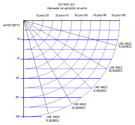
I judge my speed by my line angle of of this rod, which I try to maintain about 30 degrees from
the surface. This way my line angle guarantees I am
fishing the same water depth no matter the current/tide/wind. If I get into
deeper water or faster moving tide, I go up even to a 12 oz sinker, or let out more line.
Here, my target line counter number is usually 32', up to 42' in the medium water, up
to 65' in deeper or faster moving water. The above method governs my trolling speed over ground (GPS speed),
however remember the more line out the more drag you have so your line angle may
lesson a bit.
At a slack tide or trolling across the bay (North/South) I try to be just
under 3 mph, but as the tide starts to run the same motor speed may equate to
4.2 or even down to 1.0 mph depending whether you are trolling with or against
the tide/wind. Here I may even increase the weight up to 10 oz. If your line angle gets at your desired angle but you are bucking the
tide and your speed is say anything under 1 mph, you need to pick up then run back
to make another pass of trolling with the tide/wind.
| This chart
gives some computer driven numbers using the known angle |
 |
Wind here can be somewhat of a problem in trying to control your direction
of troll especially if you are trying to head directly into it. This is
especially bad if you have a cabin boat. For those convertible
top/windshield boats, if you open the center window, which allows the wind
to pass through the boat, and this helps eliminate the "sail" effect of the
top.
This salmon fishery can be
frustrating at times, as it can be hot and cold from one day to the other
which is possible due to the watershed being a very short as far as
drainage and not a large number of fish enter the system at any given time. You have to be there when the fish are. The people who seem
to do fairly well here are the ones who put their time in daily, year after year from August
10th to
about September 15th and learn the few tricks required, like
when and where the bulk of the fish are picked up. I
hope I am able to convey a few in this article.
It seems best to place your rod in the rod-holder so the rod
is about even with the gunwale and angling rearward maybe 45 degrees, loosen
your drag so that when a fish hits, that they can pull line
out somewhat, then put your clicker ON. Also when letting
your line out, leave the clicker on otherwise your line may free-spool off so
fast your flasher / lure gets tangled with your line and you drag it around
long enough before you check your bait that it is badly tangled. This
predicament gets worse as your sinker weight increases, in that case hand
strip the line out. I try
to have a spare rigged flasher, sinker, lure all ready in cases like this
and untangle after your new gear is in the water fishing.
Rods ? : You
will see many different combinations and lengths of rod being used here.
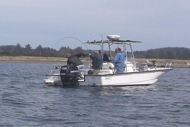
There are some who, as seen in the photo below, use rods 10' and over,
however in my mind these seem to favor the fish and can be detrimental at
netting time. They do allow an inexperienced fisherperson to maintain
tension on a fish when using barbless hooks however. And for those of
you who are convinced you need to use braid line, the longer rod helps by
being your shock absorber, where when using Mono, it is the shock absorber
and a shorter rod (8' or 9') can be used effectively. And these long
rods do allow
the fisherperson to enjoy the fight, BUT if the fish happens to be a wild
Chinook that you have to release to aid wild fish conservation, then you may have just signed it's death
warrant because you have tired it out, allowing the seals an easy meal.
Then short 7' rods
seem to have their problems also. I have settled on 8'6" or 9' rods in
a medium or medium fast action and recommending a line weight of 15# to 20
or 25#. I personally
use a 25# test monofilament line with a 40# mono leader.
Long limber (Noodle Rods) may not be ideal when it comes to
landing a fish, notice the 2 hand hold needed to stiffen the rod & gain rod
height at netting time,
where the fish is in control, not the angler |
 |
Something to Ponder : You
will see most of the boats trolling with the current (upriver/downriver).
These fish will be swimming in THEIR travel lanes which may vary depending
on the structure of the bottom and/or the tide. You will increase your odds if you zig-zag across these
travel lanes (usually north/south) rather than try to luck out and stumble
on moving fish. Also a combination of that would be to make numerous
circles, where the tide will be pushing you so that your circles overlap. However this may be impossible at times when there are a lot
of boats on the water or there is a wind blowing, but many times, you can
find a spot outside these boat travel
lanes that you can have all to yourself.
I have also thought about finding a prospective location
where you do not interfere with the other fisherpersons and anchor up, using
the current to work your lures. Kind of like a Hog Line in the
Columbia River.
Chinook Takedown : When
these Chinook do bite, is usually nothing dramatic, you may see the rod tip
make 2 or 3 quick dips, but most of the time (if you are not actually
watching the rod), you may think that you hung up on a gob of weeds. Your
line could come up in the water column and when you start reeling, the weeds
put up more of a resistance than normal, but weeds do not wriggle. It seems that if you do not detect the initial bite, even with with
the reel's drag could be set at a moderate setting, the fish may tend to somewhat
swim along with you and the boat. That is not so if it may be a fish much
larger than 20#. At least the last 12# to 20# fish I had on just seemed to follow for me
if I miss the takedown.
Or if you are not paying attention, you may just hear a ZZZT ZZZT ZZT of
your clicker. OR a neighboring boat may yell, "You Have a Fish On". If you are using monofilament line, then a modest hookset would be appropriate. If you are running braid line, then a
MINIMAL hookset.
However, when using barbless hooks, and where the hookup is not detected at
the takedown, (or soon thereafter) this could be a chance for a lost fish
because of the hook not being imbedded into bone where the fish then is not
hooked solidly. Here, with barbless hooks, your prime objective is to NEVER
give the fish any slack, keep tension on it at all times, which is hard if
the fish is not overly large AND wants to come right to the boat before the
fishing partner can get the other rods cleared and get the net ready.
It seems that most times these early fish will tend to be hatchery males.
Methods
of Fishing - Coho :
The
bulk of the Coho do not enter the bay until about mid September and later.
Usually by this time the commercial gill nets really move in and things
can become congested. However a goodly number
of these Coho appear to be non-biters for the sports fisherpersons.
But then there are a few fisherpersons that do connect more often than most, you have to have
be there with your gear in the water. In recent
years, my experience is by the first week of September about 15% of your catch
can be Coho. Some of those who target Coho will fish different areas of the bay than they do for Chinook. They
can fish shallow water, at the edge of the oyster beds during low tide and in water
even to 4' deep. Coho tend to follow the shoreline way more than
Chinook.
If you happen to see a school of Coho jumping and moving upstream at a
high incoming tide, they will be near shore. Move away from them,
run upstream, wait, then cast spoons or spinners in front of the school.
However these
fish are very spooky, so if you need to move while close to them, use a electric
trolling motor instead of an outboard. Do not let the fact that the
ones you can see are on the top of the water column fool you. The biters
will not usually be the jumpers, but beneath them.
The other thing to do when targeting the late Coho, is to move downriver below
the jetty and target them from the jaws up to the jetty on the high incoming
tide. There seem to be a couple of different travel lanes for Coho
here, one is to fish the deeper water near the center or south
side of the entrance. The other is the Northern shore near the green
roofed house that is protected by it's own rock emplacement, up to the
jetty. However this can be awful weedy if you are there on a high
run-off of a minus tide.
Area
Definition : The West boundary of
Marine Area 2-1 was changed in 2016 from an imaginary line from Cape Shoalwater
to Ledbetter point to a GPS coordinate, which is now east of what used to be the
old "C" buoy, that everyone was accustomed to using by a few hundred yards.
This westerly boundary is now described as the westerly most landfall on Cape
Shoalwater (46-44.66 N 124-5.30 W).
This can get you in trouble at times depending
on what areas are open/closed as compared to the bag limits. What the
regs say (depending on the year) from July 1 to July 31, MA 2-1 uses the same rules as MA 2.
August 1 MA 2-1 can have a more generous limit, so what can happen is if you
slide west beyond this now defined boundary AND catch a fish or two, they
need to me marked on you Catch Record Card as if caught in MA 2, where as
you probably are not aware and mark them as MA 2-1. WDFW rules usually
define an area as where the boat returns to what area is covered by the regs
at that point. The two bag limits can not be mixed. You can not
catch and mark fish caught in MA 2, then slide upriver and catch fish in the
same boat in MA 2-1 to finish a MA 2-1 limit for that day.
Or, if after the ocean MA 2 is closed, and you fish
beyond this boundary, you are in violation of fishing in a closed area.
The official Eastern separation between the bay (Marine Area 2-1)
and the river is
at the South Bend boat launch. This is where the fresh water is more
prevalent than salt water, the use of spinners and lures starts being the predominant lure and most times will out produce all others.
This area upstream to the Camp One bridge over the Willapa near the Wilson Creek launch
is fished differently and is covered in a different article. When salmon hit spinners or lures they
seem to be getting out of the feeding mode and into the reaction strike mode this usually coincides with the influence of some fresh water
and or a temperature rise.
Sonar :
Sonar/depthfinder will be your best ally here, but NOT for finding fish as the sonar cone
at 15' to 25' is going to be so small that you will have to be right over the
fish
in order to see any. It will be used mainly to help keep you focused on
the bottom depth contour, and since most of thee time, you will want to be fishing near the bottom,
to help you adjust your lure depth. And there is so much suspended weeds
that your sonar may confuse these weeds for fish.
I have seen where a fine tuned sonar
shows NUMEROUS LARGE fish arches, where IF they were actually fish, you would have to have
snagged some of them. But when you pull in your line, there are gobs
of large weeds that did not show on the surface, meaning they were
suspended. All the sonar books say fish arches are where the sonar is
seeing air in fish swim bladders. If that is so, my guess is since
these weeds are decomposing and suspended that in the deterioration process,
they emit small amounts of methane gas and clinging as small bubbles to the weed's surface,
which is what the sonar is actually picking up.
AND in this shallow water, you will find it best to lower the
sensitivity on your sonar unit, as fish can feel this electronic signal on their
lateral line and may well shy away if it is too powerful. So if you are using the same boat
that you also use in saltwater where you may be in water 200' to 300' and need to
remove "clutter" on your screen by decreasing the sensitivity there, remember to
make this simple adjustment downward, otherwise you may be placing yourself in the
90% category who don't catch as many fish.
There is
Also a Commercial Gill Net
Fishery Here:
So, go to
Commercial netting schedule, Willapa
or to check with WDFW at
the Montesano office as to when the netters are on the river, which is usually
shortly after the middle of September. If you call the WDFW,
be prepared
for them to give you some dates and commercial areas that mean
nothing to the sport fisherperson.
Here is the
Commercial
salmon/sturgeon landings. For a map of the Willapa
commercial areas
CLICK
HERE.
For a weekly account of the commercial netting
CLICK HERE.
A number of years ago, when I first started to really fish this area, I
tried to
run from the South Bend launch downriver and had to weave thru 32 net
sets at low tide which was not fun. If you are really determined to fish this river when the
gillnets are in, it may be best to slide up the North River channel and out of
the bulk of their way. Sport fishermen claim that for 3 or 4 days after the
nets come out, the sport catch drops off to nothing. This makes sense in
that the number of fish entering the bay on each tide may be minimal.
Their commercial season usually runs from mid August for a week, with the
possible week-ends off for a couple of weeks and then for about 10 days straight onto the
middle of October. You can try to fish on the 2nd day of the gillnet off
days, but I have not been really successful in doing this, (caught 1 small Coho
in one day of fishing). But by then the fish are homeward bound
and are not very
aggressive biters for the sportsmen anyway.
Legally a net can not be laid across the complete river, but you may see one
netter lay his from the north side to mid river and another netter lay his
from the south side to mid river, they tie up to each other for a coffee/BS
session in the middle. A recreational boater then will have to negotiate
around the end of the net, usually in 2-3 feet of water if it is a low tide.
The gillnetters can not legally net west of Jacobson Jetty so, when they fill
the bay in mid-September, sport fishing inside becomes difficult at best, but
anglers brave enough to fish the beach can pick off late-run kings and bright
silvers before they reach the nets.
I have also seen floating dead undersize sturgeon after these netters have pulled
out.
Launches :
There are
actually at least 8 launches that can be used in the Willapa Bay. These listed below are in sequence from
starting at the lowest one on the bay, then up the bay and then the actual
Willapa River, finally into the southern part of
the bay behind Long Beach.
(1) Tokeland, Port of Willapa Harbor
(2) Smith
Creek, WDFW
(3) South
Bend, City of South Bend
(4) Raymond
City Park (not recommended for low
tides, as it is shallow and MUDDY)
(5) Old
Willapa / Wilson Creek WDFW
(6) Bay
Center (this appears to be a private
launch)
(7) Palix River, WDFW
(8) Long
Island, Willapa National Wildlife Refuge
Depending on what part of the bay you plan on fishing, you can consider any of
these launches. For the normal fishery the preferable ones would probably
be #1 & 3, they are closer to the action and do not require running thru
a narrow channel, or longer distance.
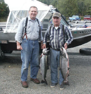
| A set
of smiles 8-30-06 |
A happy
ending to a nice day on the water 9-01-06 |
 |
 |
The Tokeland Launch :
This launch is owned by the Port of Willapa Harbor and a $10.00 fee is charged.
Pay before launching. The port has a self pay box at the south head of the
ramp for lesser used days and during heavy usage will have a port employee
parked there in a pickup truck with a sticker on it saying "Harbormaster".
Or you can purchase a yearly launch pass. This runs a year from the
date of purchase and for us old geezers is $75. You will see an average of
40 boats launching per day from this ramp during the peak fishing time during
the week of the first week of September. Weekends will be closer to over
100 and at times the launch line extends a considerable distance, however these
are not boaters, but fishermen where they have their procedures pretty well
perfected, so launching goes fast here. This number does not count the
boats that are moored there. Moorage has been increased in 2017, so more
happy fishers abound.
The boat preparation area is just south of the ramps, basically on the side of the
main road leading in. The sport
dock has moorage and the commercial docks are also available. There is
plenty of parking area in the grass parking lot to the west of the prep
area/launch.
The old
Tokeland Bait and Tackle Store has been demolished and a new
larger building has been built in 2021, but not to be occupied until 2022
when the Port is proposing to purchase My Suzie
Willapa RV Park when she retires after the 2021 season. The
plans include in this building, the Harbormaster's office, RV space rentals,
rest rooms, public showers etc.
|
Here you see the new Tokeland Willapa Harbor Port
office as of 9-2021 |
 |
Also, the RV park is to be totally renovated
and owned by the Port.
This is a
busy place during the last of August and September, especially on the
week-ends.
Come the middle of September when the
commercial gill net fleet moves into the northern part of the bay (2T), this
place becomes deserted, as it is about impossible to have recreational
fisherpersons fish alongside the gill nets. Remember recreationals
need a willing biter as compared to the nets which just take anything that
swims.
One bad ting about launching here is if it is a busy week-end, takeout
can become congested, and especially bad for the solo fisherman. Here
the wind will about always be blowing (usually from the west) when you
return to the dock. Observe it and use it to your benefit when
recovering the boat on the trailer otherwise, I have seen boats setting
crosswise on trailers as the solo operator is trying to fight the wind. I
have found that by tying up to the leeward side of the dock then using a bow
AND a stern line, with the trailer backed down slightly deeper than
power-loading, you can use the wind in your favor to drift the boat away
from your dock and inline with the trailer as you pull on the stern line and
guide the bow with the bow line using enough boat momentum, walking the boat
onto the trailer to within a foot of being fully loaded.
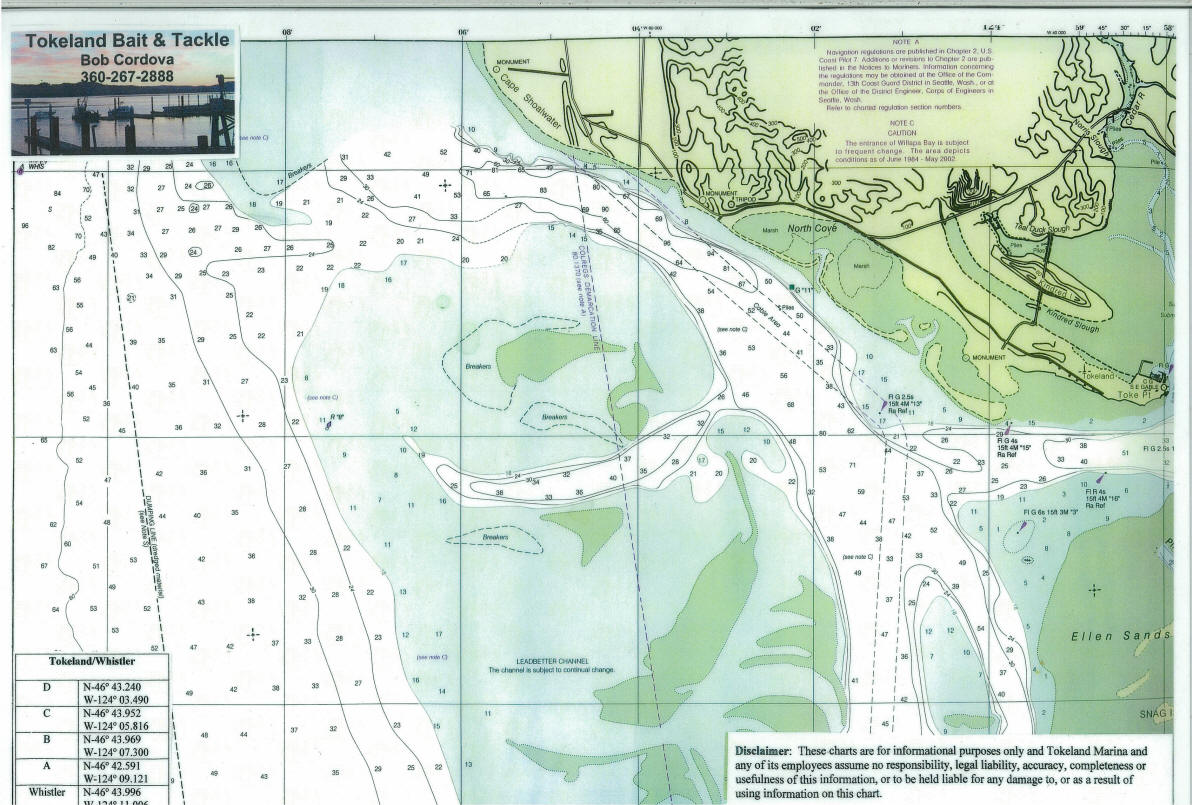
| The
upper Willapa Bay section with the South Bend launch just out of sight on
the river channel on the right hand edge of this chart |
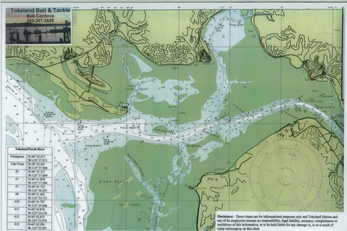 |
| The
lower (outer) Willapa Bay section to the ocean |
 |
In
early 2000 the Port redid the ramp to include a 2-lane corrugated concrete ramp with docks
on both sides. The only drawback is that each lane is a single and the
north side you had better be good at backing otherwise your pickup fenders will
be hitting the sides of the docks if you have to maneuver a lot to back
down.
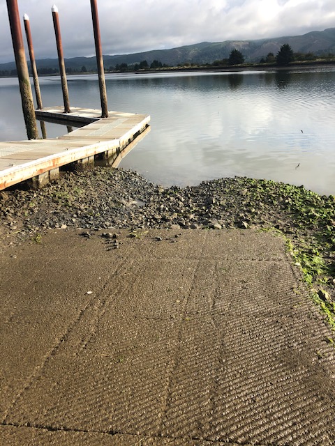
The port later dredged the whole boat basin. Now
the concrete ramp extends down to -2.0' with a bumper at the end of the
concrete. The picture on the left below was taken 7-02-04 at a MINUS 2' LOW tide. The
pole farthest out on the right has marks at 1 foot intervals with a floating foam around it, however this has long departed the scene,
probably because of careless boaters and the wind at recovery time.
As of 2014 a new harbormaster is usually parked at the ramp in the
mornings. If the tide is much below a -0- tide he will not allow a dual
axle trailer to launch until the tide comes in. Even with a single axle
trailer launching may be where your wheels have to go over the bumper at the
bottom. OK for launching, but not for recovering.
Also as you can see in the photo below, usually the north ramp is
covered with a lot of slimy mud, so he will close it first.
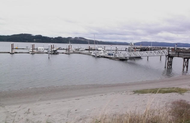
| Tokeland launch at a
- 2' tide right after the 2000 dredging, and the port re-dredged it in
2010. |
Here, summer of 2016, the old fish buying building
was demolished & the outer dock was rebuilt for more moorage |
 |
 |
In 2013 the port has received a grant for
rebuilding the boat basin, so possibly things will improve in 2014, no not
yet.
2015 saw a new small building being built to contain permanent restrooms on the ground
floor and a Harbormaster's office upstairs. Another building on the
southern end of the area is retail sales area of
Nelson's Seafood as they have vacated the "Porch". Mid September saw them
demolishing the old fish buying building off the southern outer end of the
boat basin. The rumor was that they were supposed to add 40 more
berths here. Early summer of 2106 saw the old fish buying building,
the dilapidated outer
disconnected float, replaced, providing more berthing.
Now for the good and bad about using this launch/facility. Launching
here is great even during a heavy use day, BUT RECOVERY can be the pits on a
heavily used week-end.
There is not much of an "on the water staging area" for incoming boats.
The transit dock on the north at the ramp will get congested during the week-end and no
one knows who is on 1st or even who is on 2nd. The main rental mooring
dock is totally disconnected south from the launch docks, so if you pull in
there to drop someone off there they have to walk all the way around to the
parking area and then get the trailer in line. The trailer line on the
road to the south is blocked from view for any of the returning boaters by
commercial fish buying buildings. I have seen 12 to 15 vehicles
with trailers lined up and if the first vehicle only wants to recover from a
certain one of the two lanes, then things get blocked.
The only way to accomplish a good reload is to nose up to one of the docks, drop off a vehicle driver,
let them get the vehicle and trailer in line and have him/her communicate to the boater when they
are next for the ramp access. A solo boater is simply out of luck
until the crowd dissipates.
There was such a long take out line one day, that I even
dropped off my fishers (not boaters who would or could not run the boat nor back the
trailer down the ramp), so I gave them my vehicle key and had them drive around to the Smith
Creek launch for me to recover there. And by way of water, I actually beat them
to that launch.
Fuel :
There is no fuel anywhere near this dock area for those who may moor here.
The fuel dock upriver at South Bend appears to be private for the commercial
crabbers and or other commercial boats. The closest land based gas
station would be to haul fuel from the Shoalwater Indian Reservation "Georgetown
Station" on Highway 105, they have built (10-10-2010) a convenience store/
gas/diesel station with the 3 fuel bays high enough to accommodate RVs.
However the store does not open until 6AM and if the fuel pump tells
you to get the receipt inside, you are out of luck. And during the
2013 season they also constructed another large building,
which now houses a restaurant and gift shop. One thing I like about this gas station,
they were one of the first that when you use a
credit card to purchase fuel, it asks for your 5 digit zip code. This
pretty well gives the user some security in reference to a stolen credit card as
the address is not shown on the cards.
RV
Parks :
In the
small metropolis of Tokeland, there are a few RV Parks. One just behind the bait
shop and beside the launch parking lot, My Suzie Willapa RV Park, 3230 Front Lane, Tokeland, 360-267-7710,
and the fees were $25 a day for full hook up, $150 a
week, or $350 a month as of 2013. This park has full hookups down to
tent camping.
The other is Bayshore RV Park 2941 Kindred Ave.
1-800-638-2625, which about 1/2 a
mile before you get to the launch on the south side of the road across from the
old hotel. Their website is www.bayshoretokeland.com
.
The South Bend
Launch :
This launch as been rebuilt the summer of
2004, with an extra wide single lane poured corrugated
concrete ramp with a spot or two of parking for handicapped. There is a
portable sanitary toilet on the premises.
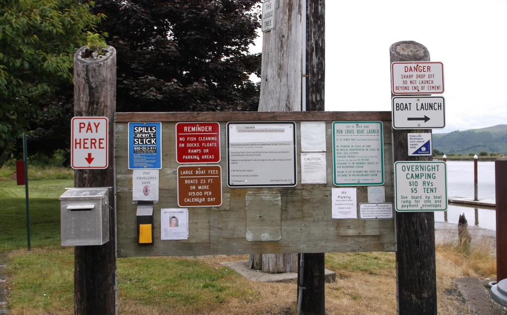
The City of South Bend has revised it's boat launch and dock ordinance the
spring of 2007. Fish cleaning is NOT ALLOWED
on floats, dock, ramp, etc. as this is in violation of the city
ordinance. There is now a $5 maintenance fee for launching at the
ramp. That maintenance fee includes one day's parking in the launch area.
One day is defined as 00:01 to 24:00. If parking multiple days, a $5 fee
is due each calendar day. Unattended vehicles without trailers are also
assessed a $5 fee. If you have buddies, with their vehicles, it is
suggested to have them park downtown and pick them up by boat at the main dock.
Also a $10 tent or RV parking fee is charged. The tent camping appears to be the small grassy area just west of the upper part of the launch
and just south of the upper end of the launch.
The sign for RV parking indicates that this is only allowed west of the sign
which is about mid point of the trailer parking. It is a little wider
here, or it appears to be some gravel extended on the west end that may be
possibly used for this parking.
A street light was added 2008 at the head of the ramp near
the information board, making early launches and late retrievals easier.
Also one can read the info on the board in predawn times.
Previously, a few did not pay claiming the dark or the fog prevented them seeing
the launch pay info.
As of 8-2009, the city has been expanded the parking area further south of
the old parking area. But now the DOT then posted signs prohibiting
parking on highway shoulder (which previously happened week-ends around late
August up thru Labor Day).
Now to confuse things, there is a Discovery Pass / WDFW Access Pass
sign near the parking area. DO NOT let this sign confuse you boaters.
The sign apparently is for vehicle parking, but to launch, you need to pay
the launch fee. Apparently the ramp is owned by the city, while the
rest is owned by the WDFW, the county or who knows.
This launch is located on the main Hiway
101 just West of the town of South
Bend. The main parking lot is just past the launch northwest of the main
launch area. It is a good ramp for boats up into the 20'+ class.
Even
the 30' gillnet boats launch here at a high tide. The
ramp is is angled out and downstream with a dock on the downstream side.
A loading/unloading float running parallel with the river as been added early 2007 off the end of the main
launching dock. The
concrete ramp goes to just below the end of the dock with heavy gravel below the
concrete that is angled down at about twice the ramp angle. This
launch would probably be the best for a minus tide launch of any the launches on the
bay area, however you may well be off the concrete.
At minus tides below -1' the slab end is exposed,
and you are on the
gravel/mud. A number of boats, 17' to 19' boats
do launch at minus tides with trailer off slabs and have no problems.
Retrieving however might depend on vehicle, size of boat, etc. I personally like a lot
of water over the slab when retrieving.
Now be aware that since this ramp and dock is situated in the river
which also can have a heavy tide running, where recovery on a outgoing tide
it will push your boat tight against the upper side of the dock. It can
be a chore to reload the boat if you park it in the middle of the ramp.
Therefore you may consider backing down normally, then just before your
trailer tires get to the water's edge, cramp the trailer so it sharply angles
TOWARD the dock. Now you can powerload (or hand line) by using the
dock's edge as a rub guide and angle the bow onto the trailer, then power on
(or mostly), doing the final loading by winching. This beats wading
out and trying to pull the bow out in line of the trailer while fighting the current.
Launching
from this ramp will put you into the upper fishing area rather soon, as you
will be running downriver and can be fishing at the big bend seen to the left
in the picture within 1
mile. The distance by water from this
launch to Tokeland is about 8 miles. However you will be fishing about 3
to 4 miles upriver from Tokeland. If you are coming in on Highway 6 at
Raymond or north on Highway 101, it is a lot faster to run the distance to the fishing area than it is
to drive around to the Tokeland launch, and then run back into the same fishing area of the river that you had driven by.
This is especially true late in the season when the fish
tend to be higher up in the bay AND if the wind picks up in the afternoon,
you can slide upriver to the launch instead of bucking a snotty run back to
Tokeland, (especially in a smaller or open boat).
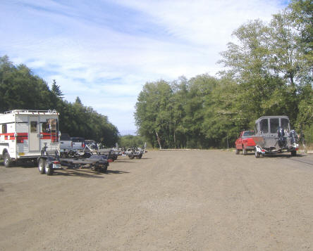
| The South
Bend launch parking lot LATE in the season (during a break between the commercial
netting) so it was a slack day. |
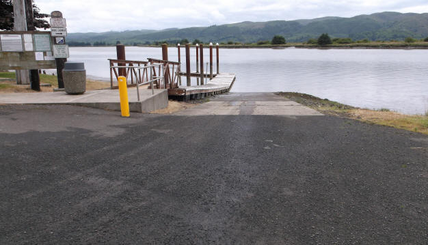
The South Bend launch with 2007 revisions, looking downriver at a medium tide |
 |
 |
Rules
Change Depending on Where You Fish:
WDFW rules define Marine Area 2-1 as anything in the bay
downstream (west) of
the South Bend launch. IF WDFW allows barbed hooks in the
marine area 2-1 BAY, it does not apply to the RIVER above the South Bend launch.
The Willapa River Area 424 is designated as from the South Bend boat
launch to highway 6 bridge approximately 2 miles below the mouth of trap Creek.
"August 16-Nov 30 night closure, single point barbless hooks
REQUIRED, and stationary gear restriction, except
stationary gear restriction not in effect from the mouth, (the South Bend
launch) to WDFW access at the mouth of ward Creek/Wilson Creek." This
barbless hooks can
be a sleeper to the unknowing and barbless tickets have been written in this upper section by WDFW.
As of 2010 the barbless hooks requirement went into effect for the
bay, as is
release unclipped Chinook, so both bay and river are now the same to simplify
enforcement.
Also for 2014, parts of the bay are closed to both recreational and
commercial Chinook retention before October 1 to protect the NATURAL Chinook.
Read you regs.
Definitions of Areas & Background Information:
If you drive the Highway 105
past the Shoalwater Tribe's casino, stop at this rock breakwater
(Jacobson's Jetty) during a mid
outgoing tide, look off the end of the breakwater, you will notice a rather
swift section of water. Since this breakwater has been installed most of
the fishing has shifted upriver after about the last of August. There are
a few "Dip In" fish that enter the outer bay ("Wash-Away") area from the
middle of July up until the 1st of September. But this depends on the
amount of bait available that they follow in. Dip In fish are
defined as ocean fish that follow the baitfish into and out of the bays on a high
incoming tide.
My belief is that this
breakwater has raised the water
speed and or turbulence to the point that the bait does not stay there in the
locations/concentrations that
it used to. There will be a tide rip off the end of
this breakwater that at times can become nasty for a small boat, depending on the tide,
as there is a drop off of 100' there from about 30'.
The fall of 2006 and then again in 2012 saw some rip-rap rocks being placed along the road below this
jetty on the banks of Cranberry Creek.
On a low tide, you as a fisherman will usually be confined to fishing the upper bay from Willapa
River marker #2 to #28. As a definition, the upper Willapa bay is
DEFINED FOR
THIS ARTICLE
is anything east of the entrance to Tokeland Marina and marker #2.
Observing the piling marker numbers, which seem to use a separate system for (1) the
outer Willapa bay, (2) the upper Willapa bay, (3) North River, (4) and the southern rivers where each may somewhat duplicate
the other. As a point of interest there is a bay marker #15 and also a
Willapa River marker #15. Remember that the lowest numbers are closer to
the mouth of each.
The south bay would contain any part of the bay behind Ledbetter
Point/Long Beach Peninsula leading to Bay Center, south to where the Nemaha and Naselle Rivers branch off. I am not that currently familiar with the markers for the southern
part of the
bay.
Commercial
Oyster Harvest : At low tide it is not uncommon to see employees of the commercial oyster
companies on the sand/oyster beds south of piling Willapa River markers #2 to #8 gathering oysters,
putting them in large baskets to be picked up by large flat bottomed oyster
barges using overhead booms and a winch later during the high tide. If
the tide is going out, you do not realize it and slip south of the piling markers
#2 to #8, you may very likely find yourself in very SHALLOW WATER, like being
stuck in the mud on the edges of the oyster beds.
There is also another method they use and that is
to drag a purse seine. This seems to work surprisingly well and
probably because they have grown the seed oysters and when using this method
of harvest are taking all the same size. They use a bag on each
side of the boat attached to booms, drag each for a certain amount of time,
hoist it up, swing over the deck and a worker trips the bottom of the purse.
I suspect by using GPS, they can pretty well identify the location and the
closeness they have come to overlapping the previous passes.
Washaway
Beach
: In the summer of 1998, the Washington State
Department of Transportation (WSDOT) with funding assistance from the
Federal Highway Administration, constructed a rocky groin and underwater dike
adjacent to State Route 105 on the north side of Willapa Bay in the vicinity
of North Beach. The structure was designed to arrest the northward
migration of a deep ebb tidal channel that, if continued to move northward,
threatened to erode the only transportation link connecting Tokeland and the Shoalwater Indian Reservation with Grayland and Westport.
This rock structure is known locally as Jacobson's Jetty, (named after
a old-time landowner in the area) as
shown by the black line in a map below, at the
upstream section that used to be the fishing area. Off the end of
this breakwater/rock jetty is an underwater diversion dike, so if you are boating here at
before a high or low run off tide, be careful of the turbulence. This jetty has
not placed there to stop the erosion of Washaway Beach as most people think, but
to protect the highway.
This jetty was not what was needed to preserve Washaway Beach as
the washing away action was not caused by the river, but the southwesterly winter
winds pounding the beach at Cape Shoalwater with no north jetty for this river
for protection. But the word was that since Weyerhaeuser no longer used
ships to send export logs from this mill, there is now no commercial traffic and
the US Army Corp. of Engineers has no authority to maintain a river mouth jetty.
Downstream of the breakwater on the
north shore is a riprapped protected house, named after the owner "Bennet".
It originally had this riprap placed just around the outer part of the
property, as things worsened, more was added making it very prominate.
Along the washaway shore in usually about 15'-20' feet of water fishermen
will troll in the incoming tide, trying to intercept Chinook entering the
bay. This however is a hit-miss situation as these are only traveling
fish. Later in the fall when Coho are moving in, I have found that
they seem to be more along the south edge of the channel, in choppier water.
It is a sad sight to walk the beach here at low tide and count the 1
1/2" to 2" metal pipes standing a few feet out of the water in line with the
washed out roads. These are well pipes that are all of what was left of the homes in
that area that got washed away over the years. The summer of 2014 at a
deep minus tide, I stood in one place there and counted 41 of these abandoned
wells.
|
At Washaway Beach, you can see some of the well-pipes protruding
from the sand at a low tide giving evidence of what is left of a housing
community. This one is artesian |
Here you can
see the aftermath of the winter's storm
at Washaway Beach. |
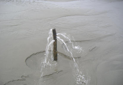 |
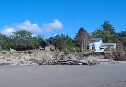 |
Fishing
Area
:
In the map below you will notice the lower buoys, as purple dots, north
side marker piling in
round green dots, the south side piling markers in red, with the launches in purple.
The piling on North River are in yellow. The piling marker numbers are indicated on this
chart. I am hesitant to give the buoy or marker numbers for the bay
unless accompanied by GPS numbers also, or as for the lower bay #13 unless
adding "by the cannery", as they may
duplicate the river marker numbers which can get confusing. Also the
map below is a satellite photo so you can see the deeper holes or channels along
with exposed
mud at which appears to pretty much be a high tide photo.
|
Willapa Bay Marine area 2-1
with the upstream boundary being the South Bend boat launch |
|
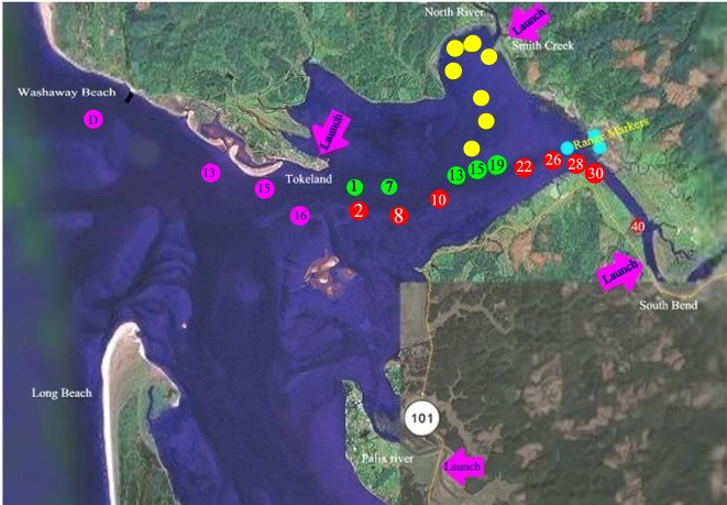 |
The Willapa River channel runs from just south of Toke
Point in the bay, east to the upriver Range Point on the bay's eastern
shore. You will see the north side green piling markers #1, 7, 13, 15, and 19 plus the red range markers on
this upriver bend. There is a sandbar south of river marker #1 coming out
of Tokeland where it gets real shallow just north of #7 so don't try to drift to much north of these markers from #15
on, as it
starts to get shallower where the mud is unforgiving on an outgoing tide.
The south channel markers will be #2, 8, 10, 22 and 26. Also do not use
one of the previous Fishing
and Hunting News illustrated map of
about the year 2000 or so. The
shaded area they list as motor mooching is really tide flats at low tide
(MUD) north of the green marker line.
And at a tide in the lowish end (but not actually there yet), as mentioned previously, do not slip south of river marker #2 to #8 as
you will be aground on a sandbar leading to the oyster beds. Below (west)
of river
marker #2 is bay marker #16. There is another sandbar that extends
northwest into the river channel that can sneak up on you in the morning if you
are running back upriver, looking into the sun glistening off the water (Been There-Done That). This bay is a
area where your sonar needs to be set at a loud 5' low alarm.
The farther west and downstream in the bay you get, the more sand sharks you
will encounter.
Most of the fishing that currently takes place are in five general locations in this bay.
(1)
Depending on the weather, some will run out to the
outer bay buoy (C Buoy) starting about 2 hours after low tide. Then troll
northerly, being pushed in by the wind and tide. They usually end up
near
Bennett's green roofed house below the jetty. By doing this
they cover more fishable area instead of trolling in with the current.
(2) Starting at just inside the
breakers at the mouth, in about 20' of water, along Washaway Beach, to the
breakwater jetty. There seem to be a few fish lay just below
this jetty at times , but if weeds are in they will be there also. But getting there especially on a
outgoing tide, it gets rather rough off the end of the jetty on an outgoing
tide for a small
boat.
(3) Above the
breakwater to the bay piling marker #11 then upriver along the east shore
about ¼ mile
(3a)
From near bay marker #13
then west to #15 along the north shore off Nelson's cannery to just outside
the Tokeland boat basin entrance. NOTE that at this entrance the markers
change numbers from the bay to river numbers so here you will see #1.
(3b) From
the Tokeland boat basin entrance
move across the channel to the south side following the red marker pilings from river marker #2 up to
river marker #8
(4) From river marker #8 to river
marker #10, #13 and up to #17 off the mouth of North River. Marker #13 is at 46-42-012 / 123-54-577
which is just east of the entrance to North River.
(5)
Then
above marker #17 and on up to
below the South Bend launch at #26 which usually takes place like most estuary
fishing on the incoming, up thru the high flood tide.
Marker #19 to #24 is in the upper of this
location that seems to be a preferred location for some, usually on the last
part of the high tide or with a south wind blowing. Then later in the
season with more wind, many move farther upriver nearer #26 to #35.
These areas will
change depending on the time of the salmon run timing, The early fish
(Late July to usually mid August) will be Dip-In-Fish. This means the
salmon as they migrate south along the Washington coast are following the
anchovy and herring, which slide into the river mouth on the incoming tide.
It is not uncommon to catch a Tule (which are Columbia River fish) in the
bay of this early fishery. The salmon feed on the baitfish, moving upriver
with the tide and then back out on the outgoing tide. It has been
documented (by commercial fishery counts) that over 50 % of these early fish
are really heading for the Columbia River and south. These early fish
will usually only be caught in the lower section, (below Tokeland). As
the time creeps into later August and September the composition changes more
to local fish, which then usually congregate farther upriver IF THE
TEMPERATURE is conducive to their being there.
The low tide difference from the ocean to this #5 fishing area is about another
hour and 15 +-
minutes. The most preferred time seems to be the last one hour of high incoming flood tide
and
then 2 hours into the start of the outgoing probably. Others fish
the low slack tide, again about an hour before and 2 hours after. This seems
the time when the bites will occur. So if there are few fish in the bay,
this is the time to fish, however if there are fish moving in, then again the
best, but you can then pick up fish all day long, only not in any quantity.
It is my
experience that a low run-off tide of say 3', (the difference between the low
tide and the previous high tide) will not be as good catching,
probably because of a lesser flow where the salmon do not move into the bay. Trolling will
normally be
best WITH the incoming tide up until about high slack tide, then the troll becomes both
directions. Trolling however may be a problem on being able to go
exactly where you want to go because of the wind or a large amount of weeds in a
weed-line. Or if there are a lot of boats fishing, it is kind of hard to
not follow the flow unless you move away from them.
I personally tend to like the low slack tide fishery for the true Willapa fish, better as the
fishable water is condensed, also forcing the fish into a more confined location.
Some so called knowledgeable fishermen say this fishery is to not really a time of the
day fishery, but a tide fishery. Well some of my catches do not totally
substantiate
that. My experience is possibly there are both a time and tide bite.
And IF you can get the two to coincide, then your chances get better. By
time, it seems the morning along with the evening are the best. And like most say, 1
hour before and 2 hours after a slack tide seems to be good. Sure you may
catch a fish or so in between, but even a blind squirrel finds an acorn
occasionally.
Do not pass up a low tide at daylight where you can get on the water and
fish the incoming tide, up thru a high slack. With the low tide, the bay
shrinks considerably. This can be a benefit in that there is a lot
less area for the fish to hide in, but concentrates the floating weeds also.
At this time is best to slide upriver from #13, which tends to have less weeds
and also
forces the fish into a smaller channel. But remember that fishing at low
tide, the fish will not necessarily be in the same location in the bay as they
were at high tide.
Also there can be a very good evening bite if the tide and wind cooperate.
Most
of the fisherpersons who set up camp there for a month and appear to be the
dedicated ones who seem to catch fish and they seem to fish only the tide changes.
But I guess if I was there for a month, that is a lot of time on the water, that
I could get tired of that much fishing. They usually get out before breakfast,
fish then go back in only to come out on the later tide change.
In the photos below these are typical hatchery Willapa Chinook. You will find
fish up into 30# range, but not many.
| A 16#
hatchery hen Chinook August 21, 2010 |
This one is
a 18# hatchery hen Chinook August 23, 2010 |
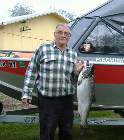 |
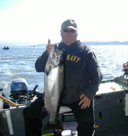 |
Method :
Probably one of the most common mistake is to get set
trolling and not realize the tide has increased in speed and you are not covering
much ground. This may be attributed to a good slack tide troll in either
direction, and then as the tide starts to move again the fisherman does not
realize just how fast it is going unless he is using a sonar/GPS that has a MPH
reading or moves past a piling but will continue to fish in the easiest direction
of travel. This problem can be eliminated if you use my line angle method
of governing the speed. Remember, a GPS reading can also read a
speed if you are LOOSING ground.
If this is the case, it is best to pick up and run into
the tide, set down then troll back with the tide. Sometimes this troll back
seems to fly by, and you begin to wonder if it is worth the effort. One very
observant young fisherman said that we are trying to reproduce the action of a
wounded baitfish and that he has never seen a wounded fish swim into a current,
but rather being carried by it. Makes sense to me.
Sometimes we just keep doing what everyone else is doing, not really
understanding why, kind of like a flock of sheep. I have also seen upriver
on a mid high tide, it being beneficial to drop in right close to the south
shore and make a pass on an inside corner.
In my mind, the ideal time would be when the high slack tide would be say about
7 AM and a full moon out. This gives you time to get out and on the
water at daylight, 5:30 AM, fish the prime
times and be off the water when the wind picks up in the afternoon. Again the wind
WILL pick up from the west about noon to 1-2 PM. If it doesn't,
consider yourself lucky. If say at 3PM the
outgoing tide is running and you are trying to troll downstream with the current
with the wind blowing you back, it is very hard to control the boat.
Under
other conditions or areas, this would be the time to troll in a zig-zag, but
here there are usually enough boats nearby that it would be way too much of a
hassle. When the conditions get that bad, you should consider calling it
quits for the day
instead of fighting the wind and getting nowhere. On second thought,
pick a likely location out of the main channel so the other fishermen are not
going to get irritated with you, drop anchor, then simply
"Plunk" your lure as if you were a bank fisherman until and if the wind
calms down.
The other mistake is to not check your gear often enough to be sure
there is no weeds on the lure. In a lot of weed infestation, pulling
it in to check every 10 minutes may not be excessive.
A nice day's
catch of Chinook to 16# & a Coho,
September 9, 2011 |
Here is a
22# Chinook, September 11, 2011 |
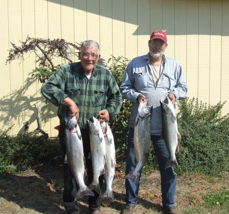 |
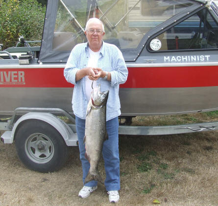 |
One trend of thought here is that the fish at the entrance of the bay will
be partially swept in by the incoming tide and maybe a few miles depending on
the tideal movement, but early
in the season it is probably that they are really just following baitfish.
This moving later in the bay may also relate to those that are committed to
their spawning run and they then will stage at the upper location they were at
and
then be migrating upstream into the out-flowing water.
Now this may vary depending on the amount of run off. If the
flow gets too strong, these Chinook may well slide into a protected area of a
depression in the bottom, or duck behind a piling marker that has collected
debris in front of it, creating a resting place. This can well be used to
your advantage.
Then trolling with the current it may well be hard depending on the time of the day
and the tide
if you have other boats in the area and you have the wind to contend with also.
Not saying you will not catch fish trolling against the tide, but your odds
become less. You will have to adjust your motor speed to keep
from just standing still. This is not a fishery where you get a lot of
upstream migrating fish passing under you. As the tide nears either low or high slack, then
there is an hour or so that you can effectively troll either direction.
The wind WILL pick up about 1 to 2 PM, so this also effects fishing.
It may lay down later in the afternoon at times (5:00PM or so if the tide is
right), but do not count on it happening. The worst days of catching
for me happened to be with an east wind, maybe this was just coincidental, with no
fish were in the bay, BUT? The worst days of trying to control the boat
when trolling is when the wind is coming from the west or south as the bay is
exposed more from these directions. The best is when it occasionally comes from the north. If it gets so windy that you can not fish
near the entrance to the Tokeland Marina entrance near marker #1 and #2, the only
thing to do is move upriver which gives you some protection with the hills to
the north and south. It can at times then be fishable from marker
#19 upriver. And there is a slightly deeper slot at #19 which sometimes
proves productive as evidenced by the fish in the left hand photo below at the
end of the high slack "Bite".
|
The 2nd
place winner in the Willapa Fishing Gang Salmon derby, a
21#
hen Chinook,
August 25, 2012 |
Here is the
brother to the one on the left, another bright 21# Chinook, August 26, 2012 |
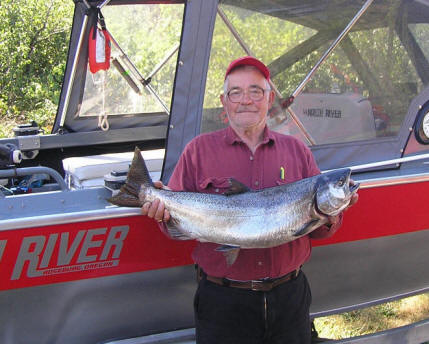 |
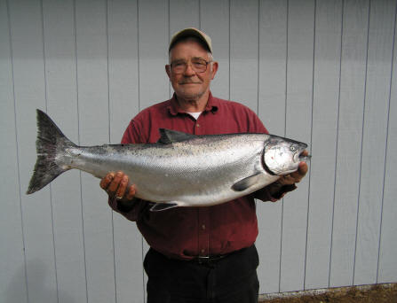 |
I have not been able to locate depressions in the bottom here like other
bays, as much of this bay (at least in the fishing areas) is rather flat or
slightly sloping. If you do find a depression or "holes / troughs", these could only be a
foot or so deep and would be a prime place to drop your lure into. If you can mark these,
and troll over them watching your depthfinder closely, as you pass over
them, let your line out, or slow the troll down to allow your bait to drop into
this hole. Fish will tend to stop and rest here, and you might just have
figured out a way to find them. If you just follow the others you
may occasionally stumble into a fish, but buy using your depthfinder maybe
even just a certain water depth on a certain tide time could be where they are
at that time of the tide.
It appears that the fish DO NOT necessarily follow the shipping channel
which is usually 35' deep, but they seem to migrate on the edges of it, in water depths from 12' to 25'
depending on the tide.
This may just be their way of staying in touch with finding their way once they
enter the rivers.
In the photo on the left below, dad confides that his daughter really
concentrates on fishing. She does not use a rod holder, but holds onto her
rod all day and has developed a sense of being able to tell when a fish is near
or
even smelling her bait.
There
Are Very Few Experts Here
:
Don't just follow the concentration of boats
thinking that is the "place to fish", as that may not be the only fishy area
in the bay. Most all the non-locals think the other guy (especially
the one with a older boat) is the expert.
I
was fishing there alone (basically trolling back to the South Bend launch), in 2001 near
river marker #30, with one other boat, while the
whole flotilla was downstream from us a few miles. The other lone fisherman
in a 12' Livingston boat, using a electric trolling
motor and the tide was almost all the way out. His 20hp Mercury outboard motor
would not start. I offered to tow him back up to the South Bend ramp. He
graciously refused
saying that he had a spare battery for the electric motor and that when the tide changed,
and started coming back in his electric motor would get him back to the ramp.
He
then confided
in me that his main reason was that for the last 2 days he had pulled his limit
of Chinook out of that area while everyone else was downriver, and we were
alone in that area then. A few years later, I have seen fishermen
jigging in that area.
Like anywhere else, a good pair of binoculars along with being observant, may
help observe the lure, location used and ultimately possibly put fish in your fishbox.
If a fisherman just reeled in to pull weeds off, watch to see how many "pulls"
that he lets his gear back out to. The advent of line-counter reels kind
of foils this method of spying however.
| A 25#
Willapa Chinook August 2008 |
A nice
Chinook in the net 2004 |
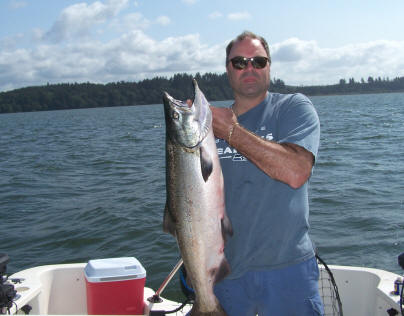 |
 |
What Gear to Use
& Methods :
The standard practice of trolling near the bottom in estuary fishing is practiced
here also. Since most large "Get There" motors do not troll down slow
enough, you will see usage of drags made of 5 gallon buckets, to actual drift
socks.
One suggestion is that since there is usually a wind or tidal
movement here, that if you are using a trolling motor, it may at times be hard
to control the boat UNLESS you lift the main motor/outdrive up out of the water.
Your trolling motor can not overcome the big rudder if you still have it in the water
right next to the smaller prop. This would be true only if you use your
trolling motor using the tiller. If you connect your trolling motor
with a connector to your main motor AND then steer using the steering wheel,
then the main motor will have to remain down.
In some estuaries, the water may be slightly murky at times, so a attractant like the Fish Flash that has little
drag seems to work best. In recent years after the patent had expired there have been copies of the
Fish Flash appear on the market. Some are made of metal while others are
plastic. Most of these have a slightly different action than the original
Fish Flash. The Kone Zone for one, has a lesser spin, this can be a benefit
if all the other boats are using the faster spin attractor. Also it is my
opinion that in shallower water like 15' or so that the slower rotating flasher
may be of a benefit because of less chance of spooking the fish if the water
clarity is decent.
The medium size rotating attractor in my opinion is best all around one if you had to pick
one, as I believe in this shallower or clearer water the larger size could spook
the fish. In the past, a red or chartreuse flashers have proved
excellent. My thought here
is that the size of this
attractor needs to match the water depth and clarity, AND if it is that clear
you may want to decrease the size of the attractor and increase your leader length a bit to move the attractor
farther away from the bait. For the Willapa, I would use the slower rotating Kone Zone or even use the small or the
mini version of the Fish Flash, if the water clarity was good. For Grays Harbor with a more
turbid condition, the large
Fish Flash works OK. That said, when I fished the Willapa in 2010, the water turbidity
was up/down to being on par with Grays Harbor but this was probably due to a a number
of minus extreme tide exchanges. You can also adjust your leader length
from short (24") in murky waters to 6' in clearer waters as sometimes I think
these fish get spooked by the flasher attractors depending on the water clarity.
If you get there and there are a lot of boats concentrated, they will
normally be trolling up or downstream, (East or West). You might move to
the side of the fleet and try something different by moving in a zig-zag pattern crosswise of the channel
(North-South). This allows you to cover, conquer the tide/wind better AND
cover more potential fishy water during a critical slack tide "hot bite"
timeframe. It also makes a presentation different than your competitors.
This may be impossible at times with a high number of boats, but you can usually
move to the side of them a bit and be out of the line of fire. Also with a
lot of traffic on the water, the fish may just be pushed to where you may have a
chance to intercept them in an uncrowded area.
It is my humble opinion that the bright fish fresh here from
the ocean should take about any salmon lure. But after they have been there a while
they became acclimated while waiting for the right water conditions to
move upstream because of lack of rain, these fish need to have a very active
lure pulled right in their faces so they strike it as a defense. This can
be a herring, artificial lure or even a large spinner. For more information on estuary salmon
fishing and tackle,
CLICK
HERE. This
article has a illustrated diagrams of the gear used.
Now if you are not connecting, do
not hesitate to change the leader length from the flasher to the lure, even down
to 24", which is the length that Al Hazelquist, the inventor of Fish Flash originally started with
for Coho in Ketchikan Alaska.
A few things I have changed
from the illustration below, one is my
extension between the mainline snap and the Fish Flash. Initially I
was using 50# Dacron, (the same as my sturgeon leaders). But here, with
all the weeds you may encounter at a high run-off tide, the Dacron seemed to attract weeds and allow
them to twist around it badly. Also I was using ball
bearing swivels. I still use it on the mainline, but have now converted over to 6 bead chain swivels on both
ends of this 50# monofilament extension. This
allows me to strip the weeds off easier after reeling in and the extra bearings seem to at least
allow some to still function as even with the best ball bearing swivel, one weed
can stop it's action, twisting your mainline. I have also found that
you may not want a golf tee added at the lower end of this extension as it may
be best to allow the weeds to accumulate here, rather than divert them rearward
onto the flasher or bait.
In the photo on the right is how the golf Tee (a
special one, shorter and just made for fishing) is set up for this type of
fishery, along with the sinker slider, beads and ball bearing swivel.
You can use different colors to help differentiate between different rods if
you like.
One thing that is VERY IMPORTANT if you use the
heavier sinkers (10 & 12 oz.) is you need to use the sinker slider on your
mainline, OTHERWISE if you attach your sinker to your main line terminal
snap, a Chinook will shake it's head when hooked, this headshake WILL use
the heavy sinker to bull the barbless hooks loose and you will not have the
fish on for more than a few seconds.
For a long time, I could not order some gear
online because I had to physically see it to determine the size that I wanted.
I have now written this down. Sampo #4 ball bearing swivels and #5
barrel swivels are used. Also #4 or #5 Duolock snaps and 6mm beads.
The sinker sliders are the large 1 1/2" size. On all this the larger
number means a larger size.
Also on the Fish Flash's
rear 6 bead swivel, I am now installing an Oregon Tackle weedguard over the swivel.
Then on the sinker dropper, I add a golf tee on the lower end so it acts as
a cap over the sinker eye, which again helps
divert some weeds off it.
|
Shown here
is an estuary salmon set-up that has been perfected for this type of
fishery |
Actual photo of mainline terminal gear |
 |
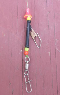 |
Fishing
here if you use the 2nd rod endorsement, it makes sense to have the second
rod running different gear, (at least until one proves to out-fish the
other). So I have recently adopted one of the methods used on
the Hanford Reach fishery, that being a 11" Pro-Troll E-Chip imbedded
flasher behind 24" of a heavy Mono extension and a lure of choice 36" behind
that. Here your lure could be Cut-Plug herring or even the Brad's
Super Cut-Plug packed with a different scent that your other lure. At
the end of your mainline use the same sinker slider and dropper as when
using a Fish Flash, but I like to run a heavier sinker like 10 or 12oz. and
fish it deeper. This flasher does not rotate, but wobbles from side to
side and with 36" or even a couple of more inches in length it gives the
lure a slight zigzag movement.
Lessons Learned :
(1)
The NUMBER ONE thing is to have snaps on the bottom end of
EVERYTHING of your gear. This is your mainline, the extension, AND the flasher, so
if you get a tangle, you can unsnap multiple items, making it easier to sort
things out. The sinker dropper is a lighter mono line ((12# or so), if
it does not want to untangle, or gets hung in the net on a missed netting
job, just break it off and replace it with another
pre-tied one.
(2) For this fishery, I have gotten to
where I will not allow any rod/reel on my
boat that is loaded with braid line. The reason is most of those who
use it do not understand the consequences if a tangle happens. This
line is so limp that when you get a tangle with another line, about the only
thing to do is cut one or both instead of wasting time trying to sort things
out. Or you will get it looped over the rod tip guide, if you blink
twice. Even just letting the gear out with a little slack at the wrong
time can lead to a tangle.
(3) Do not add any "Top Shot" mono mainline
extension, for whatever reason, as again if you encounter weeds, the knot
between the two lines can become another place for the weeds to accumulate,
becoming so bad at times that you can not reel in your mainline because of
all the grass now pulled up to the rod tip.
(4) Do not use a diver if weeds are prevalent
because even if you did hook a fish, and the diver had accumulated enough weeds
that it could not trip if a fish was on, now you are fighting a big bob of
weeds AND the fish, which now has better odds of breaking off.
(5) When trolling and you encounter FLOATING weeds
that you can not avoid,
dip your rod tip deep in the water as vertical as possible until you are
clear. Then when you bring the rod out of the water the weeds will be
on the rod, shaker it a few times and usually they will shake off.
And in doing this, twice I hooked a fish, telling me that I was fishing too
shallow.
How Deep Do I Fish? : This will probably be the one question that most fishermen will have in the back
of their minds.
Most agree that for Chinook, that about 2-3' off the bottom is usually preferred.
However think about it, this may be fine if the tide is running, where the
fish tend to hug the bottom to get out of the main current above them.
But what about nearing, or at slack tides? With no current, the fish
really now have no guidance system to upriver. What do they do? They
will probably suspend at a mid depth. So the guy who fishes 24' out with a 4 oz.
weight may be the one getting the bites until the tide starts flowing again.
I however tend to fish a bit higher from the normal 2'
above bottom to maybe up to 10' at these times. I have found it is best to try
different weights when trolling if more than one person is in the boat or
you are alone and have the 2nd rod endorsement license. This will
allow you to "search" the area and cover the water column better, where you
may get some suspended fish at about 1/2 depth with the lighter weights.
Also you may want to vary trolling speed if you are not catching anything
while others are. Even kick your trolling motor out of gear for 1/2 a minute or so. The normal fishing
locations here has a very forgiving bottom with very few snags. In all my
years of dragging the bottom here I have only lost one set of terminal gear
because of them and that could have been on an abandoned crab pot.
Now here is another thought to add to the mix. I do not run heavy weights (10
to 12oz.) UNLESS there is a tide running and you are fishing deeper water, like
Washaway (over
40').
I try to keep a line angle of about 30 degrees, so with a flat or slack tide a 6
oz. seems to work OK, but when the troll speed picks up because of the current, you may need to go to
heavier sinkers, or go out with longer line. Here most of this fishing will be in basically shallow water,
(12'-35' deep). Since you will be trolling, and at times in a confined space,
your 2 cycle trolling motor may well create enough noise if you are basically right
above the fish you may well spook them also. All the more reason to buy
yourself a new 4 stroke trolling motor.
Therefore you think your motor may be scaring the fish, you may
find you get more bites if you use a slightly lighter sinker and troll it a bit farther back behind the boat.
I do not like to set my rods in rod holders mounted so that the rod tip is high
in the air. I cringe when I see a boat with the rods set in a rod holder as if it
was a downrigger, pointing to the sky with only with a 4 oz sinker on during a
concentration of boats in the bay. Kind of makes for a lot of scowling
looks at them when they cut short in front of you as the line have to be a long
way back. But by having your rod lower and using a lighter weight you
have accomplished about the same distance and possibly less chance of a frustrational tangle
with other fishermen.
Most tangles are caused by letting the gear out too fast. Either strip it
off by hand, or keep the clicker on as you let out, which will slow down the
gear decent.
| Here the
high mounted rod holders can be a detriment. They are fine for
downrigger fishing but when normal trolling like this, the hookup to
retention ration will have a great disparity |
Here we have a lookout |
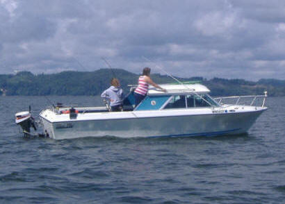 |
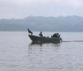 |
Again as a reminder, is
that most Chinook will be caught near the bottom when the tide is moving,
but at a slack tide they seem confused and stage near mid level of the water
depth. This means that when the tide flattens out (either high or low)
you should consider fishing shallower and/or with lighter sinkers.
One
local fisherman who seems to catch his share confided that he just uses a 6 oz. sinker
and pulls out
12 to 15 strips
of line, which would put him down about 17'. Another I know stumbled
onto a secret at high slack, by using 4 oz. sinker and 12 strips, which would
have put him down about 8-10' depending on his speed. I have also
caught numerous Chinook using a 4 oz. sinker and 15 FEET out (right on top).
Fish On :
If there are other boats near and you see a boat, not moving, or a arched rod
near you, try to give them some room if there is any chance the fish is or
will be near
your boat. Normally even a large fish will not run far here and can be
controlled near the boat. But if the fisherman is using a light rod
AND light line AND/OR is seeking the thrill of a fight, even a small (12#)
fish may not be controlled in a reasonable length of time. If this
fish happens to come near you and tangles in your line, your best bet is to
kick the reel in to free spool and thumb the spool, letting the
fish/fisherman get the fish to his boat. Your gear can be untangled or
lines cut and tackle saved later.
This happened to me in 2014. We were a reasonable
distance away from this other boat that had just passed us going the
opposite direction when he hooked a fish. The fish was running
parallel to my boat and the same way I was going. I thought our
lines were clear, but steered away just in case. I thought that I was
out of the way, but his fish changed directions and tangled my line.
We then pulled all our other gear and I free spooled my reel, thumbing it
giving line as he fought his fish. I slowly motored near
and broadside of the other boat and he netted the approx 15# Chinook.
With the fish in the net, as he raised the net handle skyward, he reached
out and unhooked my trailing hook off his leader and threw my gear over the
side for me.
Lure? :
Most bay fishermen here use large (blue label) cut-plugged herring, however you will see many
whole herring being fished there.
After seeing so much bait, (Anchovy) in the bay at times, I will use green label
which matches more to the Anchovy size. I have in the past had problems
with using cut plugged bait here, in that with the volume of weeds that are here most times, the bait gets battered a lot, changing
the cut that you tried so hard to produce.
To counteract that, one method is to
go to
the herring bonnets which perform even better than a whole rigged herring
here if you are not a proficient cut plug cutter. The best of these that I have
found are Rhys Davis made in Canada. The regular size is the Anchovy
Special, while if you insist on LARGE herring then their Super Herring Special
is the one needed. These utilize a plastic pin, but they get
lost, any round toothpick works OK to secure the head of the herring into the
bonnet. I do make one change, in that if I do not like the spin I get, so use
the round toothpick and once I get the body shape of the herring I like, inset the toothpick
lengthwise down the herring's body at the backbone line, pretty well holding that
bent shape.
This gives me more of a better roll instead of having a sharper kink at the head
giving a faster spin. I have found that the Chinook here prefer a
spinning rotation of the bait a bit faster than when being used in Puget Sound,
but slower than a normal Coho roll, however a Coho roll works very well. A second choice which is very similar is the Les Davis herring bonnet.
In using the bonnet and the faster spin facilitated by the
toothpick up the backbone, my catch ratio increased. With this all
said above, I have recently (2011) become a convert to cut plugging and my catch
ratio on the boat has increased dramatically when having guests onboard.
Possibly because the toothpick method is hard to teach someone else to get the
proper roll, and the more bait in the water the better chance of getting the
fish-box bloody. OK, I am a bullheaded German/Swiss and it takes me
longer to concede (like about 20 years).
Time for a change again in 2012, where I
went to the plastic Brads Super Cut Plug, which is made in 2 parts with a
hinged lower rear section where you can load it with herring/anchovy or even
scent. This hinged section is held together by a special rubber band.
These plugs come pre-tied with one triple hook, or unrigged with just 2
bodies for about a dollar more than the single rigged one. I like to
tie mine using 40# mono leader with a 5/0 Octopus hook on the front and another 5/0 but this
one a red Matzuo Sickle hook as the rear, tied as a solid tie moocher leader.
Both of these hooks are red in color. I place (5) 6mm beads on the leader above the hooks, but only to space the
front hook back just behind the plug. I also like to have at least 3 of
these beads fluorescent red rearward and red hooks which would simulate a wounded,
bleeding herring. My distance in tying these hooks is place one over
my little finger and holt the second hook with my index finger when tying,
this seems to be a good hangback distance. My two trailing hooks seem to slow the action down
slightly, but it still catches fish, even Coho can't seem to resist it.
I like Brad's octopus hooks for the front hook for a couple
of reasons, they are cheaper than Gamakatsu and they are heavy enough that
here in Washington State where you have to pinch the hook's barb, it is
impossible to totally pinch it, (but the law says OR attempt to pinch) so I
am legal but with only a partial pinch. For the rear hook Matzuo
Sickle hook in 5/0. These hooks disappeared from inventory not
long after they were introduced. My guess that Gamakatsu filed a law
suit for copying the design of there Big River Bait hook.
However there is one company that carries these Matzuo, and sells online,
Gerry's Discount Tackle.
This lure has the lower rear part hinged with a
sponge to absorb scent. I pull the sponge out so I can insert a
herring/anchovy or canned oil pack tuna
as a scent. If using the real deal for herring or anchovy, put
one in a bag and stomp on it with your shoe, then scoop up the mess to but
inside this lure, as this produces a lot more scent than just cutting a
strip. If you are going to use the canned tuna, be sure to
include a can opener aboard your boat, as I have never seen a can of this
with the zip top opener. It can become frustrating if you get out of
bed early, get on the water and forgot your can opener. Those copies
of the old WWII military key chain can openers work quite well for this. Or recently I have gotten lazy and simply have been squirting
Mike's liquid anchovy or bloody tuna scent into the cavity without even removing the rubber band,
which I do every time I let the lure back in the water.
I do stuff the cut-plug cavity with Anchovy scent and renew it
every time I pull in to clean the weeds off.
(Just remember to clean the cavity at the end of the day).
I have, when running 2 rods here,
ran a cut plug herring or a
herring in the bonnet on
one rod and this plastic lure on the other, at same depths. I finally
quit using the herring after a week as 75 % of my hits were on this plug,
however occasionally I still run a cut plug herring as a control.
However I do juice up the Brad's with herring or anchovy scent. As for
colors, Shamrock / Blue Hawaiian / Seahawk / Pirate, Watermelon or Pink
Magic,
even Wonder-bread
seem to produce well. However in 2012, late in the year I ran a bright orangish one, hoping to
be targeting Coho, but caught a
small Chinook on it.
|
Brad's Super Cut Plug in color Blue Hawaiian, top
view,
note
that these rear hooks are octopus, before I changed to Matzuo on the rear |
Brad's
Super Cut Plug shown with the hinged section open with modified trailing hooks |
|
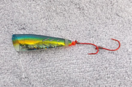 |
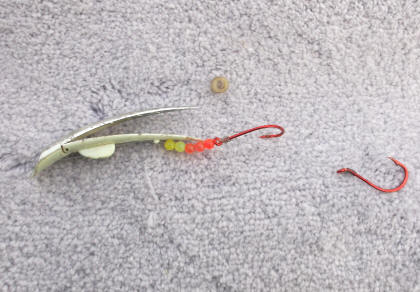 |
In the photos seen below, on the left is
this old warrior, but it still catches fish. However I am kind of
reluctant to use it for fear of loosing it and the charm that goes with it.
In the right hand photo below is a newer lure, which was designed off the
idea of an Apex plug and adding a plastic squid. The top green one is
a home-made one using part of a broken clip-board, while the bottom one is a
factory head. These can be very effective at times.
|
It seems that many times color may mean very little
as evidenced by this well worn, tooth marked lure that is still catching
fish. |
Here you see a combo of an Apex plug & a plastic
squid, called a Wiggle Hoochie which can also be very effective |
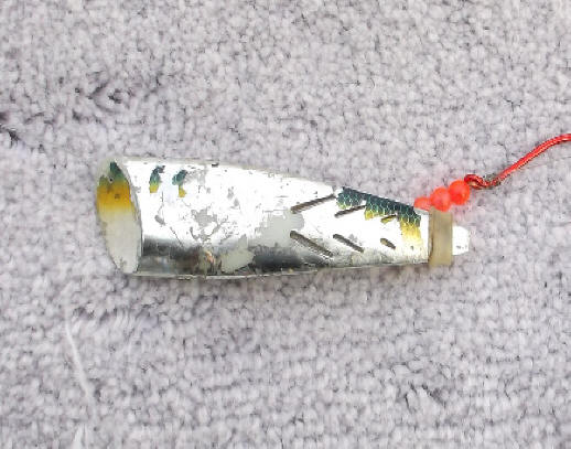 |
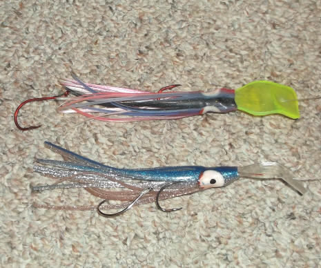 |
Fast Forward -- in 2014, I
was introduced to a newer to me and better brine cure, which really makes a
difference as far as toughness. This is "Magic Brine" bought off the
internet. I have a small insulated bait cooler that when using a
small a 5 cup size Rubber Maid container for the bait and brine, a 1/2 gallon milk jug of
frozen water just fits under the container, keeping it cool.
I use 8 oz. of this brine a 10 pack of green label
herring and just enough water to cover the bait (this container being pretty
near full). Here I place the iced jug in the bottom of the cooler, then the
Rubbermaid bait container resting on top of the ice jug, then this whole unit
inside my 58 quart cooler seat. This method keeps the bait cool all day and at
night. At the end of the day, I simply put the bait container in the refrigerator and the milk jug
back in the freezer for the next day. I even found that by placing
the Rubbermaid herring container in the freezer that using this concentration of
brine, the brine does not freeze and
I have kept bait for more days than I like to admit if I had other business and could not get
back to fish soon.
I became so impressed with this brine when somehow the
outside 120 volt receptacle on my travel trailer that I had the small freezer
plugged into became defective (ground fault in salt air). I knew power was off on some of the inside
receptacles, but did not even think of the outside one when I left for home.
I had my bait brined down for about 5 days as described above AND in my freezer,
but this time did not make it back for 10 days because of other pressing issues.
The freezer being without power, the frozen packaged bait was thawed and the freezer was stinking along with my
ice jugs being all thawed. The only possibility was to use the brined bait that I had now,
other than the Brad's lures, was this thawed brined herring. OK, cut plug
it and tough it out until the next day. These baits however looked and
felt great, they were tough enough that we drug them all day, replacing them
only after 4 hours before the belly blew out, and we did catch a 10# Chinook on
one. Needless to say I am impressed with this brine.
Some fishermen will dye there
herring, and blue seems to be the favored color, however I have not used dye, YET.
If using cut plug herring, tie your leaders so the distance between
the hooks will allow the rear hook to hang behind the tail when rigged.
In attaching the bait, pass the rear hook through the short/low side of the
belly and out the flank. The front hook should enter inside the cavity
on the low side, pass over the spine and out on the high side of the bait.
The rear hook is then poked into the last 1/2" of flesh and out at the front
of the tail, or use a small rubber band to secure the hook to the bait's
body just in front of the tail. If you think your tie is too long, go over the back of
the bait and do this poking on the opposite side. This holds the rear
hook close to the body and positions it just behind the tail which helps
hook those "Tail Biter". Or tie the leader with three
hooks, placing the middle hook at just behind the dorsal fin and the rear
hook hanging about 1/2 way behind the tail. There are many ways to do
this and they all work.
There are times that there is so much bait
(Anchovy) in the water that you will be
lucky to catch a salmon. I have even seen the seagulls so full they are
not interested in the bait showing in the bay. Your sonar low water alarm
will sound off while you know you are in 30 or 40' of water. This bait is normally
anchovies in the size of 6" long. The fisherman who uses anchovy is
probably a step ahead of the rest in that he is "matching the hatch".
However frozen anchovy becomes mushy very fast unless it is soaked in rock salt
brine overnight. Fresh anchovy would be desirable, and you could do that by
using a herring jig to catch your own bait here under these circumstances.
It is legal to use the other rod to catch this kind of bait, however you may get
stares from other boats until they see you pulling in anchovies instead of a
lure so I have resorted to using a small 2' ice jigging rod and an old fly reel
as my jigging outfit.
Shown in the photo below is a simple and very
effective method of rigging a Anchovy. Bend the Anchovy (or herring)
arching it's spine upward from the middle to the head (NOT SIDEWAYS, BUT UP).
Take a wooden skewer and insert it in the anis (or farther rearward), up and into the head, which
maintains this shape. Cut the skewer off at the body. Place the
top hook of a dual hook mooching leader into the Vee of the throat gill
convergence and out the skull behind the eyes. You may have to place
your thumb on the skull so that when the hook exits, that it does not tear
the skull when exiting. Let the rear hook dangle. If you achieve
even more of a bend than shown below, that is better. You will be amazed at the
action this rigging produces. I have in the past jigged many anchovy, and always
had problems rigging these fresh bait, this method works great.
|
Here is a simple method of rigging an Anchovy |
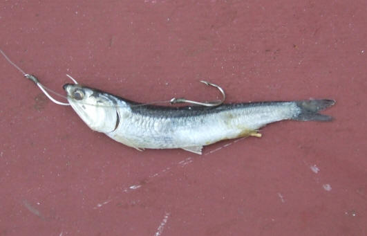 |
When you see a lot of bait on the surface and the whole water column on
your sonar is red with
bait, it is my advice to move to a different location, as your chances of a
salmon picking out YOUR bait out of millions is rather slim.
This water is shallow enough that you will normally NOT be able to "see"
many salmon on your depthfinder. You can pick up suspended weeds instead.
To attach your sinker, a lighter mono sinker dropper of about 10# to 15# mono 12"
which is
attached to a Slideo or sturgeon slider on the mainline is ahead of the Fish Flash about 16". This
distance is needed to separate the sinker dropper from the flasher and
avoid tangles with the flasher. There appears to not be any logs or brush on the bottom to
tangle with here.
Some successful fishermen will simply troll a mooching set-up.
Sinker weights from 4 to 6 ounces are normally used.
So try what you are comfortable with, however this system is more
conducive to ocean fishing than bay fishing, where the bottom changes and by
using the dropper method, your lure does not drag the bottom, but slightly
above it.
I have at times wondered if it would help if when the wind picks up and it becomes hard
to troll into it, especially if the current is running heavy, is to anchor just out of
the main fishing area, mooch a herring or plunk fish a Spin-N-Glo or large
spinner in the current upriver above Willapa River marker #15 to #19.
Or if you are fishing downriver above the jetty on a incoming tide where the
current is really pushing you upriver, then turn around and back-troll.
Or some of the successful local fishermen will just troll a large #5
or #7 brass spinner behind their small
Fish Flash. However the spinner blade
rotations seem to be critical and hard to maintain that speed when you are also
trying to fish other lures that need a different speed to operate at optimum
performance.
One thing I do at times, that gets many stares, is to troll a large
Spin-N-Glo behind the Fish Flash. And occasionally will put a gob of salmon egg roe on the
upper
hook. I use this set up basically as a spare, so if I happen to get tangled gear
or lots of weeds, I just
unsnap it and replace it with this Spin-N-Glo set-up, get it back in the water, then untangle later.
I have caught MANY fish on this lure, where adding a squid hoochie can draw
strikes.
The advent of the line-counter reels has made life a lot easier to judge
how far you are out, as you can be trolling at 20' depth with a 6oz sinker
at an average current, when you let out and hit bottom, the current will flow your
line back, let it out again till you bump bottom. Then crank it up a
couple of turns, you will be about right. It doesn't take long for you
to tell your water depth in relationship to the current and your blow back, then
being able to realize that your line footage out will be near 40' or so in the above depth. From here on, you can be pretty close by
just looking at the depthfinder and adjusting your line in or out.
One thing to consider is do not get caught up in the thought that
there is only one way to catch salmon. Try something different
Cleanliness :
Many times in things pertaining to fishing,
Cleanliness Is Next To Godliness.
Therefore, think of anything that you touch, or comes in contact with anything
that may impart a offensive odor. Do you clean your sardine wrapped KwikFish after using them and putting them away? How about cleaning your
spinners that are attached to a lure that you have used salmon roe, tuna oil,
shrimp, prawn, or even herring or anchovy scent on? Then there are your attractant
dodgers or flashers that also need to be cleaned.
One very easy method is
to purchase a painters 5 quart plastic bucket with a snap on lid. Fill
it with clean fresh water and squirt a small amount of Lemon Joy soap into the
water. Use this to soak your lures and flashers in between usage and
afterwards.
Any of these little things that many fishermen overlook, my be a
contributing factor that is why your neighboring boat is catching fish when you
are not. Years ago in my commercial salmon trolling years, we used a
gallon jug of herring oil, that after we were done pulling gear, all of the
spoons, rigged hoochies and flashers were either soaked in, or at least dipped in
until the next trip. This did three things, it protected the metal parts from
corroding/rusting AND removed any bad smells and imparted a fishy smell on the
gear for the next trip.
Kids
First Salmon :
In the photos below, on the Labor Day
2007 derby, as we were heading in, when right behind Willapa River
marker #13 was this small 14' aluminum boat with dad trying to net son's fish. Dad was
also trying to get a photo or two in between being there if and when the fish got
close enough. The boy was doing all the fighting of the fish on his
own, a real fisherman. From what we could tell, the fish appeared to be about a 15#er.
| Kid's first
Chinook, how's this for bonding? |
The kid is
just not tall enough |
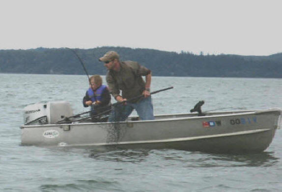 |
 |
However the distance of the flasher and leader made it rather hard for the
boy to bring the fish close enough to the boat for dad to be effective.
Numerous attempts were made, dad even to grabbing the leader below the flasher a
few times. But the wind was rapidly blowing them into
the mud flats. In these photos they were probably unknowingly in 5' of water
and getting
shallower with the fish not cooperating at all. We stayed nearby in hopes of getting a picture of the actual
netting. Finally the fish went on the other shallower side of the boat and the netting
was unsuccessful.
We pulled alongside, I got the dads e-mail
address, the later sent him the pictures that I had taken. Later when I
asked for permission to use a picture for my articles (the one that you are now
reading), he said "of course", and he had no idea who I
was, and he being from out of the area, (from Alaska, visiting a brother) he had printed off a copy of this article
and had it in the boat with
him at the time
.
This is
Not a Area to Fish if You Are Starving :
Everyone says that you just have to put your time in here. What they
are really telling you to do your own homework and figure it out yourself. Some
fisherpersons who are dumb, fat and happy may show up for a week-end of fishing
and stumble onto a perfect combination, but this is an exception.
Here you have to have enough "Willing Biters" for the recreational fleet to do
good, and here there are not a lot of fish swimming over the bar in any given
tide, so they have to "stack up" to make for good recreational fishing.
Some
of the little things may begin to add up after a few years of stumbling around.
The other thing is that the fish enter the bay on their time schedule and this
places the fishermen on a disadvantage because the fish may be there one day and
gone the next with not many more entering for as day or so. It is also my
belief that since this river system is not really that large, that the number of
fish swimming across the bar at any one time may be minimal. It may take a
few days for enough of them to stack up in the holding water in the bay before a slight
rain, barometer change, moon change, etc. that triggers them to move on,
and
then the process starts over.
This kind of puts the retired fishermen at an advantage if they rent RV
space and can be on the water every day from, the first of August until the middle of September.
This article is designed to try to improve your odds.
I have fished this area for over 20 years and I am still learning every
time I go out there. I think being very observant is more important, watch what the others are
using, but more importantly WHERE they are pulling the fish and at what time of
the tide. Talking to some of the locals
helps also, especially if you convey to them some of your frustrations.
Don't expect them to give away all their secrets, but even a few tips to a
novice is better than stumbling around for years making the same mistakes and
maybe only snagging an occasional sleeper fish, but never really knowing what
you did right.
There are
many fisherpersons camped at the RV spots near the marina boat trailer parking area. It may be well
worth your while to rent a campsite and get to know a few of the
regulars. Some days
there is no bite with only 5% of the fisherpersons bring back a fish, then the
next day new fish arrive in the bay or something changes where half of the boats bring in
multiple fish. This is a location that the average fisherperson can NOT expect to
limit out even every other day, unless you are VERY GOOD, understand the area
and are DARNED LUCKY. Then after you think you may have it
pretty well figured out, think outside the box and ask yourself, why is that guy
fishing there? And catching fish? What time of the tide is going on then?
This is not a location to fish if you
are newbie here, starving and need a fish to eat that day.
One thing you've got to understand in estuary troll fisheries
(B10/WB/GH) is you encounter biters in proportion to their relative
abundance in real-time while you are on the water. Which means the
more time you spend on the water, the more of a chance you have of putting a
fish in the box, or at least that is how it SHOULD pencil out. If
Chinook predominate the real-time abundance, your biters will be mostly
Chinook, and of course they will predominate in your catch. The same
can be said if Coho predominate. Normally Coho tend to enter the bay
in good numbers mid to late September as the Chinook are already upriver, however in 2015
that did not happen for Coho, were they late or not coming? NOT COMING
WAS WHAT WAS FOUND TO BE TRUE, by approximately 70% less than expected.
Floating
& Suspended Weeds:
As mentioned before, this can be a problem at times.
I would recommend having a spare rod all rigged up, plus have
some spare sinker droppers tied up. The reason is that at times there are
enough weeds here enough to tangle the gear.
It may be to your advantage to
stay on the beach when the big minus tides are prevalent, as the bay can
become un-fishable with sea grass broken loose, partly rotted, then
suspended in the water from the hard
tide exchanges.
If you have to fish these tides, you will
need to pull the gear in every 10 to
15 minutes and clean the weeds off.
If it happens to be tangled, switch rods and then take your spare time undoing the tangles.
If there are a lot of weeds where you are dragging around a lettuce laced herring, you
will probably not be getting any bites either. Every minute you have your lure
in the water being fouled, or not in the water, cleaning it is pretty sure you
are NOT going to get a strike.
The worst weeds are the fine green hair like weeds, that seem
to be near the bottom and stirred up with high run-off tides. These
plug up your swivels and can lead to twisted line. The large wide
grass shown in the RH photo below are a lot easier to remove.
| A
typical trolling set up from a 18' boat |
Weeds
tangled on the terminal gear & flasher, notice the Spi-N-Glo & weeds
in the upper LH |
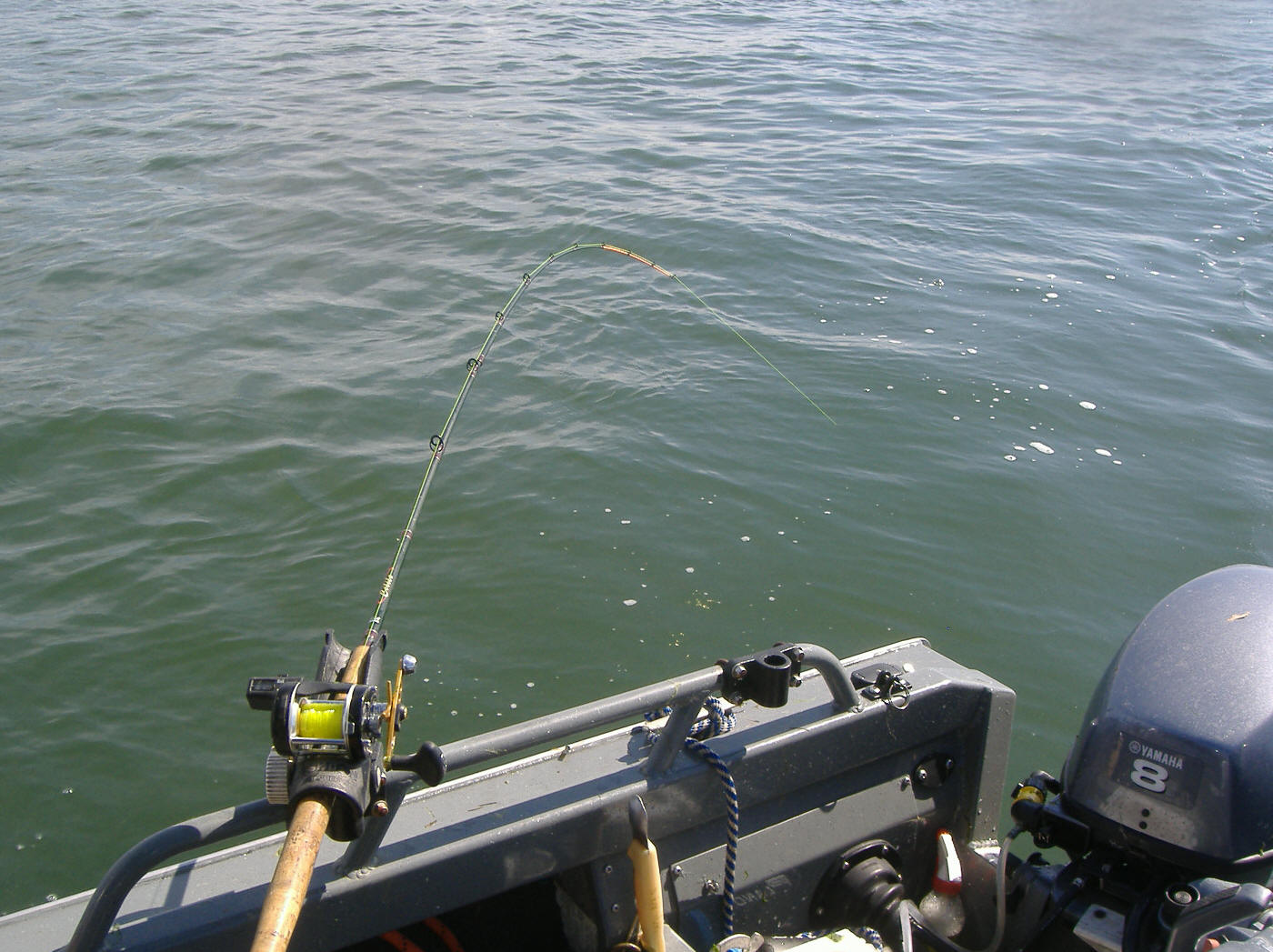 |
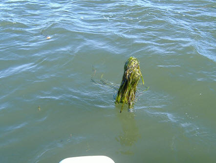 |
Some bad days, if every fisherperson would place all the weeds they removed from their
gear during the day in garbage bags and placed it someplace on the shore later, I am sure
that before long the whole bay would be devoid of floating weeds.
Tokeland Bait & Tackle
Shop ; The bait and tackle shop
here has a good supply of bait, tackle, munchies and information.
CLICK
HERE
SADLEY
THIS SHOP CLOSED DOWN IN 2018 BECAUSE OF THE WDFW REDUCTION IN FISH PLANTS
NWMTA Salmon Derby ;
This derby is usually the Saturday closest to
Labor Day, so expect it busy that week-end.
CLICK HERE
AGAIN, CLOSED
Where to
Fish :
We
will start this section of the article at the furthest downstream fishery with the old main fishery in
outer Willapa Bay itself. For many years
the place to fish was to troll the beach in 15’ to 25' of water along "Washaway
Beach", just inside the main channel mouth on the north shore of the river
near North Cove. This section of the bay is the westernmost section that
comes right to the outside ocean breakers. The name was coined after many
acres of land, probably 4 or 5 square miles of land was washed away by winter
storms. Over the years the ocean/river washed away over a mile of beach,
including many houses and the old Coast Guard lighthouse.
Most of the sport fishing upriver will be in or near the Willapa River's
old shipping channel.
For some reason not much sport fishing is conducted in the south arm of the bay leading to
the Nemah and Naselle Rivers.
Washaway Beach :
This would be part of the outer bay. You will now (2009) find
fishermen plying the waters of Washaway Beach from the middle of July up to the
middle of August, during the incoming tide. It appears they are relearning how to fish
this bay. A couple of hours after the tide starts coming in, they
slide upriver to the area just south east of the breakwater in a pocket that forms all
the way up to piling channel marker #11 (46-43-103 124-02-279) in from 25' to 50' of water.
What they are fishing for in these two areas at this time of the year will be ocean Chinook
and Coho. These fish are not
actual Willapa fish, but "Dip-Ins". They are more than likely Columbia
River fish that are following large schools of anchovies into the bay on the
high incoming tide.
Here you need to fish for them higher in the water column since they are
not yet committed river fish. Usually the fishing depth, no matter the actual
water depth will be about 15 pulls (30') out from the reel. Medium sized
herring or anchovies seem to be the preferred bait.
There is a yellow Can ("D" buoy) about mid stream off the end of the
breakwater GPS#s 46-43-254 124-03-388.
| This photo
taken from slightly upstream
of the breakwater, at a minus 1.7 low tide, with bay marker #11 hid behind the dead
tree on the point of land. This shows the beach ridge where fishing occurs
just outside of on a high incoming tide where an an eddy is formed from
the breakwater just out of sight on the right. |
Standing at the same location as the photo on the left, looking
downstream at the breakwater & outward at the Bar, from the
Hiway pullout just east of the breakwater,
with Washaway beach & what is left of Cape Shoalwater in the
distance on the right. |
 |
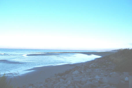 |
The photos below depict the same area as shown above only
January 1, 2010 at 11:45 AM with a wind of about 20 MPH blowing from the
southwest and the high tide of 11.1' expected at 12:15 PM. Low tide is
expected at 7:15 PM at -1.8'.
|
This photo taken from the same location as the one above. Note
that on this rock island is what appears to be a post in the
center. Think again! |
This photo taken from the same location as the one above, but looking
Northwest toward the breakwater. |
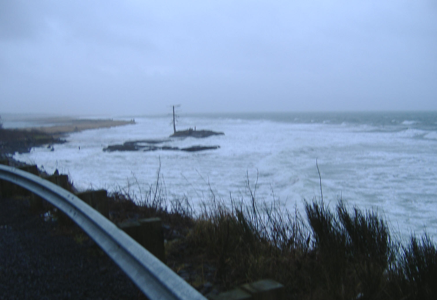 |
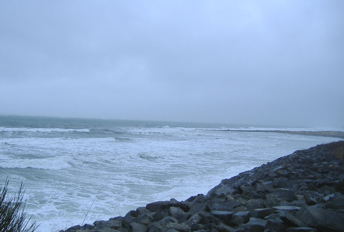 |
In the photo above, the "post" is in reality a woman standing
there apparently mesmerized by the wind, rain and waves. There is probably
8
feet of fast moving turbulence water between her rock and the shore when the
wave is OUT. There
was another 1/2 hour before predicted high tide, but with the wind blowing the
waves in, probably add at least another hour to that. The waves were
breaking over the seaward side of the rock and washing very near her feet at
times. Now by the time the
tide goes out far enough for her to get ashore it will take AT LEAST another 4
or 5 hours.
She will have had a lot of time to be by herself along with possibly get wet before she gets back to her SUV
parked at the old road approach.
After the 2011 winter storms, the dead tree on the island shown below
has now been washed away, however one local source said no, that it was
someone who needed dry firewood for a beach party and cut it down.
| Here is a
close-up of the sandstone island with the tide out about 1/2 way |
 |
Lower
(Outer) Willapa Bay:
This area will be upstream from the Washaway area
and off the residential area of Tokeland near the
Willapa Bay channel marker #15 at 46-42-086 123-59-743. I
would also consider this area outward into the main channel to where the bay
splits and the Willapa River runs east where the Nemah and Naselle Rivers branch off
and
heads south.
I have seen bait
(usually anchovies) so thick in the main
channel off what used to be Sand Island,
that if you had a long handled net you could have gotten all the bait
you would need for the next year. Usually where there is bait, there are
also salmon. This time there was so much bait that our lures simply got
lost in the crowd. I have also caught fish in the outside the main channel, but
crossing the bar can be dangerous for a small boater that does not understand
tides/bar crossings. As just outside the point of land, the channel angles off to the Southwest
and
somewhat parallels the breakers. Recent reports are the bar's channel has
changed to where at a low tide the depth is less than 15' out for 1/2 a mile. If you have a wind
and tide running,
it is best that the small boater remain inside.
However, if you do decide to sneak OUTSIDE, here is a tip to REMEMBER.
For a small boat, watch the weather AND the tide. Remember that the
wind will almost always pick up about 2 PM. To cross the bar, you want
to do it in the morning about an hour and half AFTER low tide, (the calmest
part of the tide). This means you need a low tide at somewhere between
6AM and 9AM, to give you enough time to fish and then slide back across the
bar on the high incoming before the wind picks up.
Heading out you need to be heading out almost in a due westerly course.
This bar is shallow, at a low tide you may be only in 15' of water, and it does
not get any deeper (a gradual slope) until you get to maybe 45', then on
slightly faster to 65'. Farther out it drops off to 90'.
This shelf is where you want to fish. There is (was) the old
Willapa Entrance buoy, 46-41-850 124-10-400 that has now been removed
by the USACE.
| Here
the old Willapa Entrance buoy "W" |
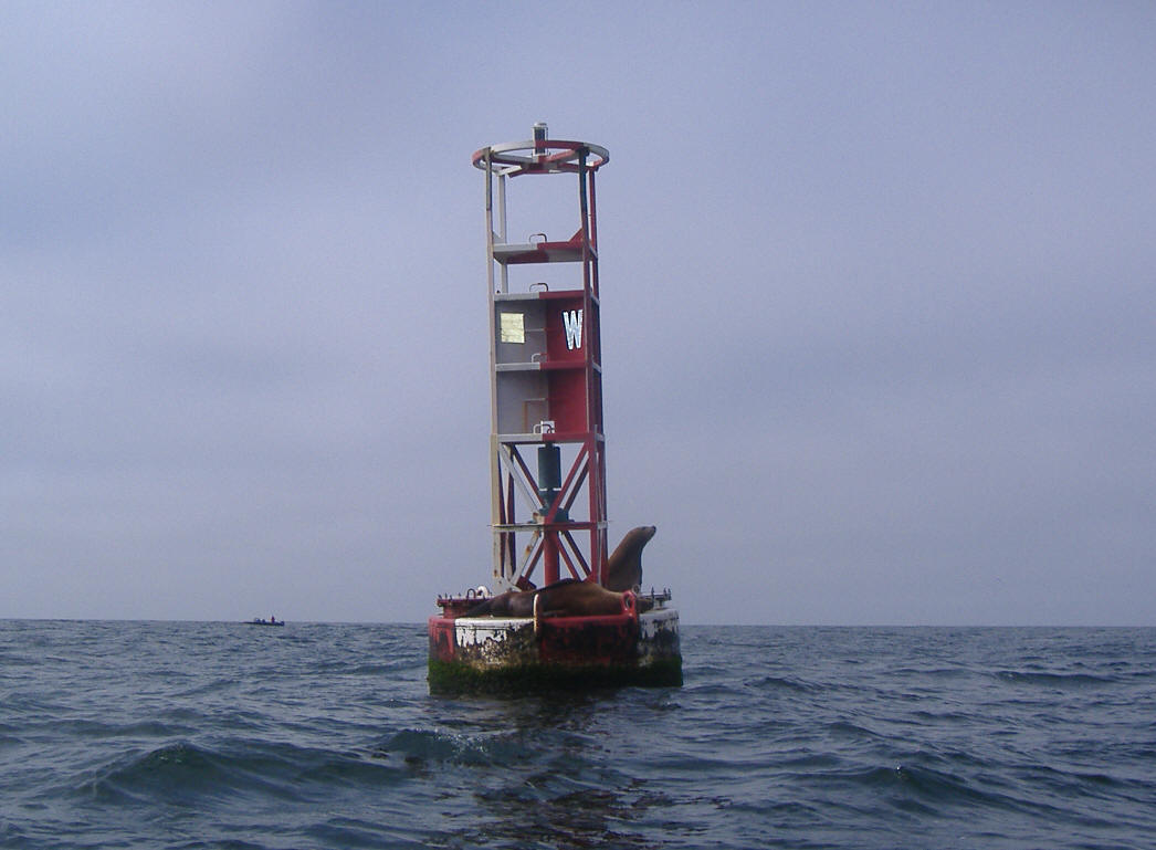 |
For further information go to
"Ocean Fishing from a Small
Boat".
There used to be a "South Channel" to the open ocean, which was a 50-60' deep large area just south
of Sand Island and north of Leadbetter Point. This area can change
yearly. There at one time a slot thru, but not anywhere near what I would
consider using as a ocean access. It is NOT recommended crossing here
to the open ocean.
As of the summer of 2000, sandy Sand Island had pretty much been washed away
after the installation of the rock jetty downstream a couple of miles. This
did improve fishing somewhat from the standpoint that there was a colony
of seals living on this island that were then displaced.
2002 and 2003 saw some of the island visible at low tide, however, but
apparently not enough for the seals to return to in any numbers.
2010 saw the island return and in 2011 multiply
considerably, as at low tide it is now rather large and home to MANY harbor
seals.
Upper
Section of The Bay:
This is where the bulk of the salmon fishing takes place. In the end
of August 2005 during a local salmon derby, when I was at about Willapa River marker #13, looking upriver
and then downriver, I being in about the middle,
counted over 120 boats in about a 3 or 4 mile section. This is about as
crowded as I have seen it, but still enough room for everyone, even including
the larger boat that wanted to zig-zag thru the parade. The 2006 derby
day saw lots more boats but no real problems.
The one main complaint is that the boat skipper will also usually be
fishing and if
they happen to be sitting on the stern facing one direction steering the kicker
motor, they usually do not look to their back side, then if you get one skipper
facing right with the other facing left, (with their backs to each other)
sometimes the other fishermen aboard may have to advise the skipper
of a close encounter coming up. This can really get exaggerated if the
skipper is cleaning his gear of weeds with the is wind blowing.
When heading upriver from off Willapa River piling marker #2 (which is about straight
south of the Tokeland harbor entrance), to #8 it is rather straight
with the river,
then from #8 to #10 is a slight northeasterly jog, then straightens out easterly again to about #26.
The channel has shallowed up between #13 and #15 so you may only have 20' here
instead of the normal 35' channel. My thinking here is
the current is somewhat slower on the sides of the channel. Also observed is
that the
Coho tend to cut across the "flats" (15' - 20') at high tide, from south of #10
and
blend back into the main channel upstream near #19.
As the season progresses and or the weather (wind)
becomes bad, many fishers move upriver even above #19 and on to the bend
near the upper range marker and marker #29 and #30, which can also be
productive at times as there is a 30' slot near marker #30. And it is
more protected in the afternoon form the wind up there.
If you fish the bays enough late in the season, you may see Coho jumping within 5 feet of shore at low tide in less than 2
feet of water, while everyone is trolling out in deeper water. There
are no piling or protective brush here, but they must may feel more secure than
in deeper water that all the boats are crowded into. Here the fish seem to be moving
upstream in small schools. If you see a school of finning or jumping Coho,
they will be moving upstream. Follow them without spooking them, or run on the other side
of the river to avoid them and then go above them hoping to intercept then
again. Cast #4 or #5 spinners to these fish with a spinning outfit.
However the bulk of these Coho seem to have been afflicted with lockjaw.
A 14# Chinook
hen taken September 16, 2006
by my little brother |
Here a 21# Chinook hen was just netted by a solo fisherman (Me),
August 25, 2012, note the net handle
pointing skyward, closing the bag as the fish comes aboard |
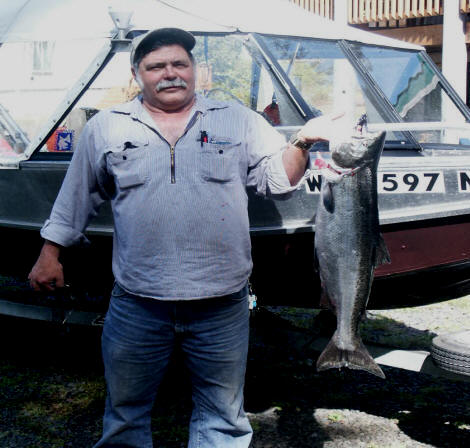 |
 |
North River :
The river itself empties into the bay at the Highway 105 high bridge on the
north end of the bay. The shallow narrow river channel wonders thru the bay
terminating just west of marker #13, closer to Tokeland and between Southbend. This lower
section of this river channel itself can be productive IF you happen to find a school of fish in the channel.
This is a situation where the Smith Creek boat launch can be utilized. This launch is situated right at milepost #10 on
Highway 105. This launch has the concrete slabs ending at
waterline of a 0.0 tide, has crushed gravel below the slabs, but there is
about a foot of
drop off. One word of caution on launching at a low tide, this ramp
will be muddy AND SLIPPERY. As you back down be DAMNED SURE that as
you approach the lower end of the ramp that your trailer is goings straight,
as if it drops over the slabs while still having the boat on, it will pull
your vehicle down the ramp no matter how much brakes you apply. Not
enough to be in trouble as you can then unhook the winch line AND safety
chain, but if you were not truly aligned with the ramp, you could be pulled
into an awkward and possibly a dangerous situation.
However a larger tall boat may not be able to get
under the low Smith Creek Highway 105 bridge at a high tide to get the 100
yards needed to enter into North River.
Early spring of 2013 saw new bridges being built over both the Smith
Creek and North River. These are concrete spans for both
the Smith Creek and North River bridges. Both replacing the old wooden
bridges. The height under the Smith Creek bridge at a high tide of
8.9', I have hit about 3" of my tall VHF antenna on
my North River boat, and it extends 10' above waterline.
With my new radar and the all around light above it, my passengers say that
I have about 16" of clearance to my light.
|
Smith Creek boat launch & old Highway 105 bridge
at a HIGH tide of 9.2' with storm warnings, raining
heavily and 25 knot SW winds pushing the tide in holding the run-out back
10-14-2012 |
Here
is the new Smith Creek bridge that was finished in late 2013 |
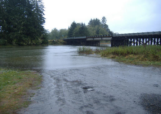 |
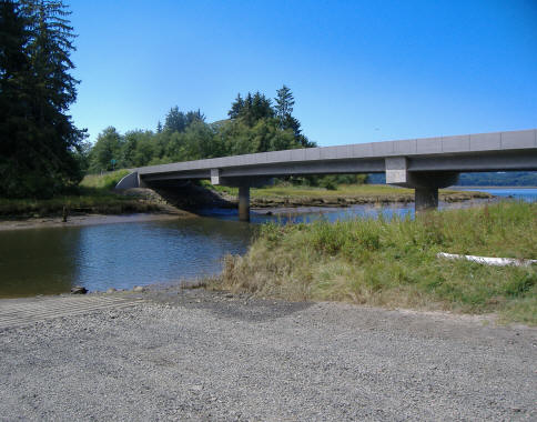 |
One thing to watch for from this launch, downstream to the first big bend
are deadheads. If you are watchful, they will be obvious at a low tide.
However they do move from year to year. And farther downriver at the large
LH bend, hold WIDE on the outside corner at any tide other than high, as the
inner corner has sanded in.
There is no public launch on North River itself, (however there is a
private launch behind a locked gate) but a WDFW launch on Smith Creek just off
North River. Heading out (downriver) from the Smith Creek launch, you go under the Smith Creek bridge,
about 100 yards you will enter North River. Go down-stream (left)
heading west staying between the piling markers, (but in deeper water
closer to the LH markers) you will then enter a slight left hand corner with a marker on the right. This is only one more RH piling
below on this corner until you come to another left corner. All of these markers are set up for a returning
boat, so you have to look at the shape from the back side to determine which
they are. The triangle ones are (or should be) red, while the square ones
should have been green.
Remember Red Right Returning code for the markers.
There are usually a couple of dead-heads in this channel out to
this first big bend, however these change year to year, so be on the lookout for them. I have
only seen one deadhead below this bend but it was there only one year.
The factory installed GPS locations on my Lowrance HDS 5 unit for North River I
have found
that the markers #19 and #28 are
way wrong as they are in the mudflats to the east of their actual locations.
However the river water depth coloration is correct.
From the left big bend you will be
heading mostly south, but at a low tide hold wide (more to the center of the
channel of this corner piling as there is sanding shallows there. Stay on the West of these piling (except for a couple on
the far west shore after you make the first big bend) watch your depthfinder,
this channel is usually about 8' however after the big 2007 flood, it
shallows up to 4' at a -.05 tide on the next LH corner as you pop out into the
bay.
The red/green
marker signs (or what is left of them) are designed for incoming boats so the colors
with the numbers (what is left of them) being hard to distinguish. This channel however is
pretty well marked and deep enough for navigation until you get close to the
actual Willapa River channel which can be narrow and SHALLOW for the last 1/4 mile.
There is no actual marker at the entrance of North River. From the last
piling marker in this river, you need to
be headed west of Willapa River marker #13 and more toward marker #10 at this point, which
is actually across on the south side of the Willapa channel (or toward the most RH point of land in the distance). This last section near the
Willapa markers shallows up slightly just before it drops off into the Willapa
River channel, so at a low tide, your target would be west
of #13. My GO TO location here is 46-42-100 / 123-54-670 before you actually enter the Willapa
River channel.
It is best to have a GPS/Plotter and follow the river channel. Be very
watchful of the markers, as even the seasoned traveler here (Me) can get distracted
(like wiping off the inside of the windshield in a slightly foggy day) and find
themselves setting on the mudflat (been there-done that). Fog will
be the worst (which happens this time of the year) then I suggest you do not
travel this river unless it is a clear day, or you do have a GPS/Plotter that
you have set to record your trails, and depth-finder.
It takes a boat that will plane, only about 12 minutes to get
from the Smith Creek launch to Willapa River marker #13, (unless there is
fog and/or you are new to this area).
There was a private hatchery program on this river that
released a considerable number of Chinook, Coho salmon into
this river every year. However the elderly gentleman doing this passed
away possibly sometime near 2005. The WFDW does not make this information readily
available however as they do not plant any fish in this river. And it is
not known to what extent the old man's project has played on current fish
stock.
Tidal changes for this Smith Creek launch will be near 2 hours later for a
low tide using Pacific Ocean tide book
reference.
One bad thing about this launch is that the parking lot is not square with
the ramp slabs and to compound things the gravel above the slabs that blends
with the parking lot is arced in a manner so that when you are backing the
trailer toward the ramp you can not see the slabs and since it is not square,
this further compounds seeing where you need to be going. As of
9-1-09, I had driven a steel fence post on the downstream side of the upper
slabs giving some reference point for the slabs, which someone removed.
Otherwise try to have one of your passengers
stand at the top downstream top of the slabs to give you some
reference, OR I set out a traffic cone.
To compound the launch problem of the ramp not being square with the
parking lot, some not so thoughtful boaters, after they launch, don't pull
ahead far enough into the lot, park the trailer and vehicle close to the area
needed for a subsequent vehicle to pull into to be able to back in straight to
the ramp.
In the left hand photo below, you will notice the 4" X 12" planks on the
old bridge supports. They have 6" between them. You can also see the
high water mark on them.
At the -1.5' photo shown on the right,
I would not recommend trying to launch even if you have a 4 wheel drive
vehicle or if you have a boat trailer that uses roller bunks.
Here there are not many real protection areas where the
bait and fish may rest, other than a
few slightly deeper sections of the bay. However there is one, which is at
the upstream side on the point where bay marker #15 is located. This
however will only hold fish on the incoming tide. You will also
occasionally see shore bound fishers in chest waders casting jigs off this
beach near the marker. For the boater, fish close to shore (like 25' of water) and do not
move far upstream. I have seen numerous fish pulled here within a 200 yard
circle upstream of the marker piling but very few above that.
The other area is downstream of the jetty on an outgoing
tide. However this area can be the pits for weed accumulation if you are
in a minus tide.
Also above the jetty and up near the small sandstone island
then up to Marker #11 is a spot to try, here it is a much larger area so not the
chance for any real concentration of fish, but better than stumbling around
elsewhere in barren waters.
Then upriver off the sandbar at marker #7 should be about the
same situation on a incoming tide.


