Chehalis River Salmon / Steelhead Fishing in the Upper River
|
|
Chehalis River Salmon / Steelhead Fishing in the Upper River |
|
Spring Chinook ;
IF there are enough spring Chinook
predicted to return for any given year, WDFW may open the Chehalis River for salmon
fishing above the Porter bridge for spring salmon May 1 thru July 31 and for
fall salmon, from the middle of October thru the end of February. Trout
and Steelhead season is usually closed from April 16th thru May
31. The
marine area code for punching your salmon punch card from the Porter Bridge to
Black River is (317). The old boundary pre 2012 was to the high bridge on the Weyerhaeuser
1000 line above PeEll. This was changed in 2012 to the upper boundary
being the Highway 6 bridge at Adna because of the fewer number of predicted
returning fish, and is code (315).
There are only natural spring Chinook and steelhead
in this river (no hatchery supplementation). There are a few volunteer
RFEGs for Coho egg raising and fry release however, most being unmarked fish.
Fall Chinook ;
There is usually no Chinook season open in this upriver section above the mouth
of the Skookumchuck River, to protect what natural spawning is there.
Salmon and steelhead fishing here is not that great
because of the fact that the Quinault Indian netting that occurs on the lower
river. Yes, I know the 50/50 Boldt decision and the fish co-management
with the tribe, but it really cuts down on fish above the nets. And the
legal length for retention of cutthroat trout is 14" which you will rarely
encounter anything that large here.
There are NOT a lot of boat launches in this stretch of water and the
water is not a slow lowing river in many places, a jetsled or driftboat would be recommended. Bankfishing is somewhat limited by the combination of fishable water/banks
and obtaining landowner permission.
Coho ;
The early run may start early September depending on the water
flows. They usually spawn in the creeks with the rains/high water about
Thanksgiving. The late run will follow possibly early November and spawn in the
upper rivers (not enough water in the creeks then) starting possibly Christmas
and into Jan-Feb.
Lures used depending on turbidity, (1) High turbidity
usually a Wriggle Wart, in either a orange or Pirate color. The rigging is to
remove the rear hook, add a 4 beadchain swivel off the front hook ring and a
single hook off the chain. (2) #5 or #6 Vibrex and again a single hook replacing
the tripple. (3) a 3/8 oz jig, usually a dark tail, with Chartruse head and
green tinsel hackle.
Colors and sizes for high turbidity are bright,
where the size of lures (especially plugs) for clearer water will the to the Wee
Wart size and not as bright color, seaHawk being one.
One fisherman I know uses the
USGS Grand Mound river gauge
as his go to when
fishing this section where he has found a flow of over 3,000 cfps as his minimum
for fishing from a boat.
Boat Launches ;
(1)
The lowest boat
launch in this described section is the
(2)
(3)
(4)
Borst Park WDFW launch at Centralia
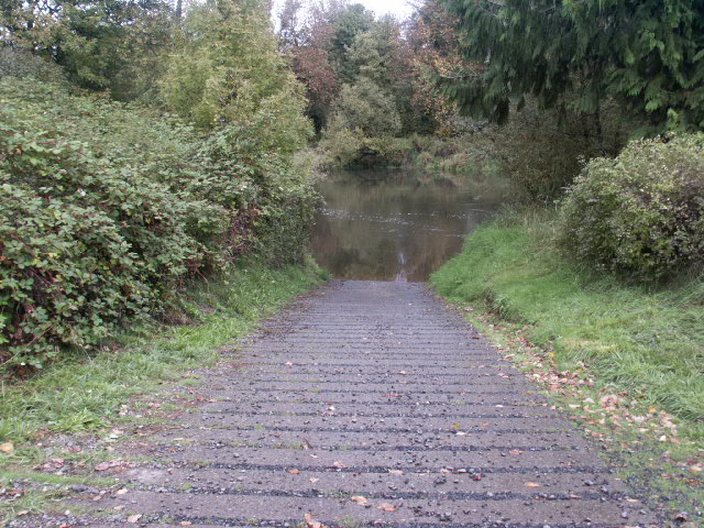
The Porter bridge boat ramp appears to be a WDFW unit. It
is located just west of the river bridge and the first road to the left goes into a large gravel parking
lot. The single lane concrete launch is located in a slight back-eddy for protection. There
is lots of parking and restroom
facilities here.
| Porter bridge boat launch |
 |
The
Oakville launch is situated off Highway 12. This launch is on the 1st road to the left as
you exit Oakville going west and
is on the Gate Elma Rd. West. It is only
out there about 1/4 mile from Highway 12. Gravel parking for about a
dozen vehicles and appears to have a spot for bank fishing just downstream
from the launch. There are no signs off Highway 12 or at the site indicating public
fishing or boat launch. This launch has a loading area where the boat can
be nosed into shore just downstream from the actual ramp.
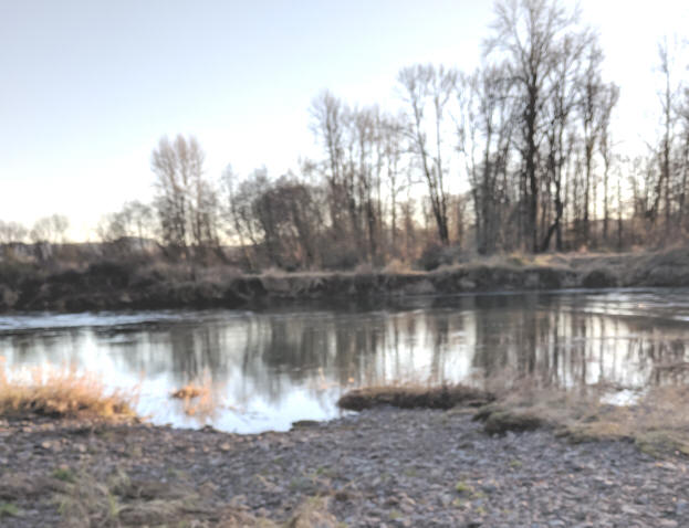
| Oakville launch on a frosty morning |
|
|
The Black River launch while not on the Chehalis is close enough to access the
main river. It is immediately downstream from Highway 12 where it crosses Black River, about 2
1/2 miles east of Oakville.
Gravel parking for a dozen vehicles. The Chehalis River is downriver about
2 miles as the crow flies, but farther by water as Black River winds around a
bit before it empties into the Chehalis and has some shallow water in places
depending on the flow.
|
Black River launch |
Downstream from the Black River launch |
|
|
|
For
the Borst Park launch, from I-5, at the Centralia northern exit onto Harrison Street
(exit 82), go west 2 or 3 stoplights, (depending which side of the
freeway you exited from). Between the 2nd and 3rd light, a Safeway
store will be on your left. At this 3rd light, (Johnson Rd) get into
the left turning lane. Turn left, head south, about 2 blocks
there is a 4 way stop with the Centralia middle school beyond on the right.
Go straight ahead and at the end of the school parking lot, the road tees at
the ball fields. Turn right for about a block and then a left. Follow thru the ball field
parking lots then ahead you will see the restored Borst home. There
is a sign for Historic Borst home and boat launch with an arrow to the right, take
the road to the right which will take you past a park maintenance shed.
Just beyond this shed/lot is the launch parking on the left. The parking
lot has lots of chuck holes, and the parks dept may use it for dumping loads of dirt /gravel in the
center as a dump/storage dwindling the parking area. However there
are ball fields near with some parking areas that if not being used could act as
an overflow.
When
you leave, you do not have to go back the way you came, but can head west from
the parking lot, then north and back into the residential area which will
take you back to the 4 way stop at the school. You could come in
this way also, but it is harder to describe.
| Borst Park launch |
|
|
Most of the fishing in this area of the Chehalis will be from boats,
and will be from the Skookumchuck, downriver to below Rochester. This is
mainly because of 3 or 4 miles of slow "FROG" water with limited bank
access upstream from there to the Highway 6
bridge just west of Chehalis and then about the only holding water will be
about 1/2 mile above the at bridge to the mouth of the Newaukum River.
Above that is limited bank access, not only because of private property, but
because of a lot of high brushy banks. The
only real access would be at Rainbow Falls.
Not a Lot of Boat Accessible Water Above the
Mouth of the Skookumchuck ;
The
Chehalis river here can be navigated by prop outboards from the launch upstream at a mid
water lever, however, there are a few large rocks just above the launch area that has
been known to eat
props at low water. Above that is a lot of flat frog water where a prop
boat could navigate, but not conducive to salmon or steelhead fishing until you
get upstream to the town of Chehalis. Below this launch can be navigated
for about a mile until you get to the bend shown below, is Jetsleds or drift boats are usually used
from the launch downriver toward Rochester.
About a mile downriver from this launch
the river had a island and a corner riffle combined which created a bad
situation for small boats. After the 2007 flood, the channel changed to a
more straighter flow but still has a riffle as seen in the photo below.
For late Coho, this now side channel could provide some fishing, away from the
main current.
| Google map view of area described above with the flow from the right to left. |
|
|
Above
this Borst Park launch about 300 yards or so is the mouth of the Skookumchuck River
entering from the left (east). There is a trail thru the main park, south to
a bankfishing area at the downstream side of the mouth of the Skookumchuck, but
only usable when the water is lower. Upriver
farther on the Skookumchuck in the
Centralia city limits, east off Harrision Street "restaurant row" is Riverside Park with
some bank access. Across the river is bank access from the Church of the Nazerene
parking lot, but usable by a free parking permit from them for use of their parking
lot.
| The mouth of the Skookumchuck at the far bend, looking upriver from the Borst Park launch | The Chehalis at the mouth of the Skookumchuck (on the left) looking upstream from the bank fishing spot on a foggy morning |
|
|
|
The Skookumchuck
itself has a fish run in it as there is a hatchery upriver very near the base of the
dam. Coho and
steelhead are the prime targets for this river. River access can be at the
Schaffer Park on the northern edge of Centralia where the road Ys to the
Centralia Steam Plant. Also river access upriver from north of Bucoda has a
couple of public access with limited highway access but plenty of public walk-in below the
parking lot. Above this public access, with walk in beyond the gate, there
is access to the river along the old field up to the deadline below the base of the dam.
In talking to the
Skookumchuck hatchery personnel, the run timing to start
fishing in any quantities of Coho, (early run) would be about mid November.
Late run Coho would be about from early December to New Years. However
this late run is considerably smaller than the early run of Coho. And
Steelhead, from late December to March.
| Skookumchuck River at Riverside Park in Centralia | Skookumchuck River at Schaffer Park just north of Centralia |
|
|
|
Above
the Skookumchuck's entrance, the Chehalis River water is flat, meandering, slow flowing until you get upriver to the
city of Chehalis. There are a couple of riffles behind the city of Chehalis
and fishable
water at the mouth of the Newaukum River. This hole at the mouth of the Newaukum
can be public accessed bank fished
with the access from Alexander Park, which is accessible from the 1st county road to the
left after you cross the Highway 6 bridge just west of I-5. getting
to this area, you go into the park, hang a immediate left and just before the
trail turns to the right, there is a trail DOWN to the inside corner of the
river. This trail goes down a steep bank, with a small beach at the
waters edge.
| Upper 1/2 of pool below the mouth of the Newaukum River |
Newaukum
River in background entering the Chehalis
at low summer water |
|
|
|
There
will be fishable water in the Newaukum all the way up to Onalaska where there
the school raises and releases Coho and steelhead. Again bank access
would be the prime consideration.
Above the Newaukum River, the main Chehalis River has not really much fishing/holding water for salmon, and from Adna upstream, only conducive to limited drift boat fishing, with only a few private gravel bars to launch or take out on, so it is more suitable for bank fishing IF you can find a location, AND get permission. The photos below were results probably because I have lived here for 81 years and know all the old timers. Many of the newcomers (last 30 years) seem to have different ideas, however a package of smoked salmon may be a persuader.
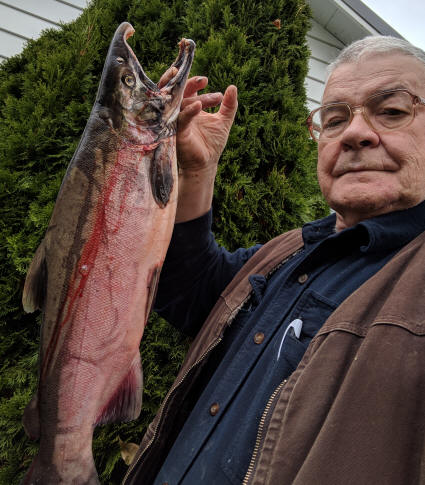
This Coho in the RH photo below appears dark, having those bight pink sides, which is common for these first fish that have been staging in tidewater until the first rains come. It however cut bright redish meat. One method of telling if the meat is good was supplied by a experienced guide who says if the tooth line is still white, (as seen here) the meat is OK. It was caught on a #5 Blue Fox, with pink body and a small pink hoochie. Later fish will usually be brighter as their journey is faster because of higher water.
| Typical pool | Typical Coho taken late October after the first rains & the water was on the fall, giving bank access |
 |
 |
Since the 2007 flood this section of the river has changed dramatically, creating lots of Chinook spawning gravel, but very few holding water areas. It also has what appears to be good Steelhead water, however few of these fish exist here as there is no planting program here anymore.
As mentioned, there
are a few meaningful bank access areas above Adna to the Rainbow Falls area. At the Boistfort
area, the South Fork of the Chehalis empties into the main Chehalis. This
LH picture
below is taken
off the railroad bridge crossing the South Fork just above where it meets the
main river. This South Fork is
closed to salmon fishing above the Boistfort school bridge, but is open for trout
and steelhead. It however also has little or no public access as it goes
thru all private farmland.
| The South Fork of the Chehalis on right, looking downstream off the railroad bridge to the main river on the left | Casting into a pool on the upper Chehalis above Adna for trout during a summer pontoon boat float trip |
|
|
|
Above
the Boistfort/South Fork bridge about 3 miles on Highway 6 (just past the old garbage
transfer site) is the River Rd to the right, down it about a mile or so on the
LH corner is an unimproved parking area (owned by WDFW that they do not
advertise) that leads to the river which is close
by. Here is a deep hole with a rocky riffle above on a corner. This
pool below has fishable water, but usually a float/bobber works best as there
are large jagged rocks in the bottom, precluding any drifting.
| Here is a rocky riffle at Meskil | The upper head of the pool below the Meskil riffle |
|
|
|
Above
the Boistfort/South Fork bridge about 5 miles is Rainbow Falls State Park, which
is right on Highway 6. The pictures below were taken off the bridge across
the river entering the park's picnic/camping area. These two bridges were
wiped out by the December 2007 flood. There is parking
along the wide shoulder of the highway at this area and a trail down to the falls
under the old now missing bridge from the upstream highway side.
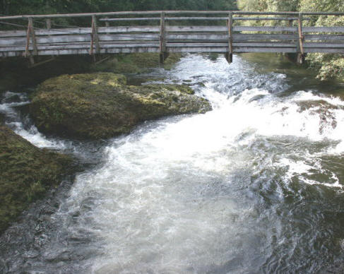
This falls will usually stop fall
salmon migration until the fall rains raise it enough to allow fish passage, and
the fish usually use the LH side channel as most salmon can not jump the falls
unless the water is high. The photos below were taken before
the 2007 flood that wiped out both bridges to the park that these photos show or
were taken from. One of these bridges was scheduled for replacement
2013 / 2014, but has not happened yet as of the fall of 2025.
| Rainbow Falls showing the LH side channel | Pool below the falls |
 |
|
Above
Rainbow Falls, the locals seem to think the river belongs to them, and with very
little access unless you know, or are related to the landowner.
Copyright ©
2005 - 2025
LeeRoy Wisner All Rights Reserved
Back to the Main
Ramblings Page
Originally written 10-05-05
Last Updated 04-10-2025 *
Contact the author